Tag: New
-

The U.S. Geological Survey (USGS) Releases New Heights of Accuracy for World Topography
The U.S. Geological Survey (USGS) and the National Geospatial-Intelligence Agency (NGA) have collaborated in the development of a much improved global elevation model, the Global Multi-resolution Terrain Elevation Data 2010 (GMTED2010). GMTED2010 replaces the widely used, 15-year-old GTOPO30 terrain model as the best available global digital elevation model. Useful for regional-, continental-, and global-scale applications,…
-

Maptek New Mid-range I-Site 8400 Laser Scanner Released
New Mid-range I-Site 8400 Laser Scanner Released Tuesday, November 29th, 2011 Mining technology specialist Maptek unveiled the new I-Site 8400 laser scanner at Intergeo in Germany at the end of September. Built at the Maptek I-Site manufacturing facility in Adelaide, South Australia, the I-Site 8400 has been launched following the international success of the long range I-Site 8800. The…
-

New TigerSupplies Showroom for High-Quality Architectural, Engineering and Survey Equipment
New Jersey, New York Metro Architects, Engineers and Surveyors Access Expert Service and Quality Equipment at New TigerSupplies Showroom IRVINGTON, N.J., Nov. 3, 2011 — TigerSupplies.com (http://www.tigersupplies.com), the leading online resource for high-quality architectural, engineering and survey equipment, has brought its unparalleled expert service to main street with the recent opening of a brand-new showroom.…
-
New Version of Topcon ScanMaster Software Improves Scanning Performance
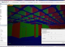
New Version of Topcon ScanMaster Software Improves Scanning Performance LIVERMORE, Calif. – Thursday, October 27, 2011 Topcon Positioning Systems (TPS) has released a new version of software used with Topcon’s GLS series of laser scanners – ScanMaster v2.5. The new version was designed to improve existing features, add new functions, and broaden applications for scanning. “We’ve…
-

Professional Land Surveyor Weekly Roundup October 9, 2011
Professional Land Surveyor Weekly Roundup: Professional Land Surveyor Source Twitter Weekly Updates for 2011-10-09 Knowing Your Numbers-Project Metrics for Your Land Surveying Company LightSquared CEO on The Communicators Senator Chuck Grassley Continues to Pursue Information on LightSquared, Agency Interaction Elgin & Knowles-The U.S. Public Land Survey System (PLSS) for Arkansas Reference Book and Manual New…
-

New Esri Basemap Highlights Thematic Content
Free Light Gray Canvas Basemap Service Now Available October 6, 2011 User data shown on top of Light Gray Canvas map is easier to distinguish compared to user data displayed on busier maps
-

C-Nav Announces New 5cm GNSS Service
C-Nav Announces New 5cm GNSS Service Lafayette, Louisiana, October 4, 2011 – C-Nav, the premier supplier of international GNSS Precise Point Positioning services is pleased to announce the launch of its improved five-centimeter C-NavC2 GNSS subscription service. C-NavC2 supports GPS + GLONASS corrections and delivers the most accurate real-time Precise Point Positioning solutions around the world.
-

National Geodetic Survey (NGS) New CORS Coordinates and Absolute Antenna Calibration Pages
National Geodetic Survey (NGS) Releases New CORS Coordinates and Absolute Antenna Calibration Pages NAD83(2011,MA11,PA11) epoch 2010.00 Coordinates On September 6, 2011, NGS updated the National Spatial Reference System NAD 83 (CORS96, MARP00, PACP00) positions and velocities for all CORS sites, to NAD 83 (2011, MA11, PA11). The NAD 83 (2011) frame, which is relative to the…
-

Leica SmartWorx Viva v4.0 for Viva Total Station and Viva GNSS with Exciting New Features
Leica SmartWorx Viva v4.0 for Viva Total Station and Viva GNSS with exciting new features 4 October 2011 (Norcross, GA Oct 4, 2011) – Leica Geosystems is pleased to announce version 4.0 of the easy-to-use Leica SmartWorx Viva onboard software being available in November 2011. This new version is packed with exciting new features to make…
-

Professional Land Surveyor Weekly Roundup October 2, 2011
Professional Land Surveyor Weekly Roundup: Professional Land Surveyor Source Twitter Weekly Updates for 2011-10-02 Trimble’s Portfolio of Survey Solutions Allows Surveyors to Collect, Share and Deliver Data Faster to Improve Productivity Optech Announces New Airborne Laser Terrain Mappers (ALTM) Models: Orion M/C 300 Spectra Precision Introduces New ProMark 800 GNSS Receiver and Survey Pro 5.0…
-
Optech Announces New Airborne Laser Terrain Mappers (ALTM) Models: Orion M/C 300
Toronto, Canada, September 26, 2011 Optech Incorporated is pleased to announce the latest addition to its innovative line of airborne laser terrain mappers, the ALTM Orion M/C 300. Available in two models, the Orion M300 and C300 are specifically designed for mid-altitude engineering and low-altitude corridor applications respectively. Both models are now equipped with multipulse…
-
Spectra Precision Introduces New ProMark 800 GNSS Receiver and Survey Pro 5.0 Field Software
Spectra Precision Introduces New ProMark 800 GNSS Receiver and Survey Pro 5.0 Field Software NUREMBURG, Germany, Sept. 26, 2011 — Spectra Precision introduced today several additions to its growing portfolio of solutions focused on mainstream surveying and construction needs. The announcement was made today at its Worldwide Distribution Conference held in Nuremburg, Germany. The expanded product…
-

Professional Land Surveyor Weekly Roundup September 25, 2011
Updates & Upgrades In this week’s Professional Land Surveyor Weekly Roundup, I want to explain a few site upgrades in addition to this week’s summary. If you are a regular visitor here, you’ve no doubt noticed a new look. You also might have found some of the site features updated, too. What’s happening, simply is…
-
Hexagon Enters Into Exclusive Partnership with Locata Corporation for a Completely New Positioning Technology
Hexagon has entered into an exclusive industry partnership with Locata Corporation Pty Ltd to integrate the revolutionary Locata positioning technology with Hexagon’s positioning receivers. This collaboration will leverage each company’s expertise to create the world’s first combined GPS-Locata positioning receiver. For the first time customers will have access to a tightly integrated solution providing high-precision…