Tag: Engineering
-

Video Overview of AutoCAD Civil 3D
An Overview of AutoCAD Civil 3D Watch as Kevin Breslin shows you how AutoCAD Civil 3D’s building information modeling can be used in a sample project — including: Import of survey data. Use of the intelligent modeling features. A good primer for those looking to learn about Civil 3D.
-
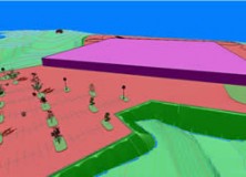
Carlson Survey 2012 Embedded AutoCAD Now Available
Carlson Survey 2012 Embedded AutoCAD® Now Available MAYSVILLE, Kentucky, U.S.A. — Carlson Survey 2012 Embedded AutoCAD®, Carlson’s feature-rich, intuitive surveying office software with the AutoCAD engine built in, has just been released. Among the top improvements in the affordable Carlson Survey 2012 Embedded AutoCAD version is increased 3D visualization, new 3D coding in its industry-renowned field-to-finish,…
-

Gatewing Introduces Stretchout UAV Desktop Processing
Gatewing Introduces Stretchout UAV Desktop Processing Ghent, Belgium – December 15, 2011 – Gatewing®, manufacturer of the revolutionary X100 unmanned aerial system (UAS) for mapping and surveying, introduces Gatewing Stretchout™, a breakthrough image processing solution which automatically converts your X100 image data to accurate orthophotos and DSMs. “With Gatewing Stretchout™ we’ve challenged the accepted way…
-

Autodesk Agrees to Acquire Horizontal Systems
Autodesk Agrees to Acquire Horizontal Systems Acquisition Extends and Accelerates Autodesk Cloud-Based BIM (Building Information Modeling) Solutions for Collaboration, Data and Lifecycle Management Autodesk University 2011 SAN RAFAEL, Calif. & LAS VEGAS–(BUSINESS WIRE)–Autodesk University — Autodesk, Inc. (NASDAQ:ADSK), a leader in 3D design, engineering and entertainment software, announced that it has signed a definitive agreement to acquire Horizontal Systems, a…
-

Autodesk Previews Upcoming 3D, GPS and Plot to Print Capabilities for AutoCAD WS
Autodesk Previews Upcoming 3D, GPS and Plot to Print Capabilities for AutoCAD WS Mobile Design Evolves With 3D Collaboration, Location Features, and Remote Printing Autodesk University 2011 LAS VEGAS–(BUSINESS WIRE)–Autodesk, Inc. (NASDAQ: ADSK) announced several new features to be added to the next release of AutoCAD WS, a free* web and mobile application that enables users to…
-

New TigerSupplies Showroom for High-Quality Architectural, Engineering and Survey Equipment
New Jersey, New York Metro Architects, Engineers and Surveyors Access Expert Service and Quality Equipment at New TigerSupplies Showroom IRVINGTON, N.J., Nov. 3, 2011 — TigerSupplies.com (http://www.tigersupplies.com), the leading online resource for high-quality architectural, engineering and survey equipment, has brought its unparalleled expert service to main street with the recent opening of a brand-new showroom.…
-

Midwest Architects & Engineers Supply Joins the GeoShack Family
Midwest Survey Joins the GeoShack Family DALLAS, TX – GeoShack North America, Inc. continues to grow with their latest announcement that Midwest Architects & Engineers Supply Inc. has joined the GeoShack family. Midwest A&E was founded in 1956 by Ed Nicholson and has been at its present location, 400 North Grove Road in Richardson, Texas since 1984. Current…
-

ClearEdge3D Wins Prestigious National Science Foundation Grant for Automated Feature Extraction Research
Funding will greatly improve the company’s feature extraction technology; goal is to virtually eliminate manual modeling of facilities, buildings and entire cities Herndon, Virginia — September 21, 2011 — ClearEdge3D today announced that it has won a research grant from the National Science Foundation (NSF) to further develop its technology in the rapidly evolving field of…
-
Professional Land Surveyor Weekly Roundup September 18, 2011
Professional Land Surveyor Weekly Roundup: Professional Land Surveyor Source Twitter Weekly Updates for 2011-09-18 USGS Historical Topographic Map Collection Now Online Sokkia Releases NET-AX Series of Automated Total Stations for 3D Monitoring LightSquared Video to Debunk Several GPS Interference Myths-Facts or Propaganda? Defense Department Seeks to Protect GPS Operations Against LightSquared Network House Aviation Subcommittee…
-
NCEES Seeks Professional Land Surveyors as Volunteers for Fundamentals of Surveying Examination (FS) Exam Content Review
NCEES is currently seeking professionals working in surveying to participate in a content review for the Fundamentals of Surveying (FS) exam. The results of this study will be used to update the test specifications for the exam.
-
What is Geomatics Engineering? Video
What is Geomatics Engineering? This video was brought to you by the students of the Geomatics Engineering program at California State University Fresno. Watch the What is Geomatics Engineering? Video
-
Gene Dinkins Elected National Council of Examiners for Engineering and Surveying (NCEES) President-Elect
Delegates elected Gene Dinkins, P.E., P.L.S., NCEES president-elect at the organization’s 90th annual meeting, held August 24–27 in Providence, Rhode Island. He will serve as president-elect for the 2011–12 term and as president the following year. A resident of Columbia, South Carolina, Dinkins has been a member of the South Carolina State Board of Registration for…
-
Autodesk and Kelar Pacific Present Building Information Modeling (BIM) Business Best Practices at Executive Dinner in September
Leaders in BIM Software and Implementation Show Construction Decision Makers How to Use BIM as a Business Driver SAN DIEGO, Calif., September 6, 2011 Kelar Pacific, an Autodesk Gold Partner and Design and Consulting firm, will host an educational seminar, The Business of BIM Executive Dinner, for construction executives and decision makers interested in the Building Information…
-
Virginia Tech Students Win First Place in the 14th Annual Carlson Software National Senior Design Competition
Results of the 14th Annual Carlson Software National Senior Design Competition Are In Virginia Tech Students Take First Place MAYSVILLE, Ky., U.S.A. — Congratulations to all of the schools that participated in the 2011 Carlson Software National Senior Mine Design Competition.
-
MicroSurvey Releases FieldGenius 2011
MicroSurvey® Releases FieldGenius 2011 July 29th, 2011 – West Kelowna, BC – MicroSurvey is pleased to announce a major version update to MicroSurvey FieldGenius, the world’s most powerful data collection software for land surveyors. FieldGenius 2011 now supports more devices than ever, under a wider variety of hardware configurations – high definition, standard definition, tablet-style, portrait…
-
New Topcon Total Stations Are Chosen for Europe’s Largest Construction Project
105 MS05AX units to be used in London tunneling project LIVERMORE, Calif.–(BUSINESS WIRE)–Topcon Europe Positioning B.V. announces the recent award of an order for more than 100 high precision robotic total stations for the Crossrail project in London, UK. The order is one of the single largest orders for total stations ever recorded. “We are…
-
Free Intermediate Surfaces in Civil 3D Webinar by Kelar Pacific
I want to inform you about a free AutoCAD Civil 3D webinar available tomorrow, July 26, 2011. This free webcast is “Intermediate Surfaces in Civil 3D” is being held by Kelar Pacific. Free Intermediate Surfaces in Civil 3D Webinar by Kelar Pacific Details
-
What’s New in AutoCAD 2012 Video
Here’s an Autodesk produced video on what’s new in AutoCAD 2012 Video.
-
AutoCAD Civil 3D Surveying Quick Tips and Tricks-How to Rotate Model Space
In today’s AutoCAD Civil 3D Surveying Quick Tips and Tricks I will show How to Rotate Model Space. This technique can help you to speed up your AutoCAD Civil 3D drawing by aligning your model space other than having north straight up. The Problem: By default, AutoCAD Civil 3D drawings are oriented with north pointing up. This sometimes…
-
Eagle Point Software Corporation Announces 2012 Updates to Its AutoCAD Civil 3D Companion Solutions
DUBUQUE, Iowa – Eagle Point Software Corporation announced the 2012 release of its AutoCAD Civil 3D software companion solutions: Data Reduction, Designers’ Companion, Surveyors’ Companion and Pinnacle Series Task Navigator. These 2012 releases are designed to help civil engineering professionals deliver more innovative project solutions by enabling building information modeling (BIM) processes. “We are excited to announce the release…