Your cart is currently empty!
Tag: 2011

AutoCAD Civil 3D Template Sale
AutoCAD Civil 3D 2011 and 2012 Templates Sale With the release of the first of our 2013 AutoCAD Civil 3D templates, we’re putting our 2011 and 2012 AutoCAD Civil 3D Template on sale. 25% Off 2012 AutoCAD Civil 3D Templates All of our 2012 AutoCAD Civil 3D are marked down by 25%. 2012 AutoCAD Civil 3D…

Professional Land Surveyor Weekly Roundup April 1, 2012
Professional Land Surveyor Weekly Roundup: AutoCAD Civil 3D 2012 and 2013 System Requirements Compared Side By Side Working With Images And Surfaces Premium Video AutoCAD Civil 3D 2013 System Requirements AutoCAD Civil 3D Drape Images Over A Surface Video Professional Land Surveyor Weekly Roundup March 25, 2012 Professional Land Surveyor Premium Post Updates How To…

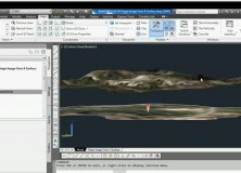
AutoCAD Civil 3D Drape Images Over A Surface Video
AutoCAD Civil 3D Drape Images Over A Surface Video This AutoCAD Civil 3D for Land Surveyors Video shows you how to drape Images over a Surface.

AutoCAD Civil 3D How To Trim Image to a Surface Border Video
AutoCAD Civil 3D How To Trim Image to a Surface Border This AutoCAD Civil 3D for Land Surveyors Video shows you how to trim an image, like a geo-referenced aerial photograph or orthophoto, to a Civil 3D Border.

AutoCAD Civil 3D How To Insert Geo-Referenced Images Video
AutoCAD Civil 3D How To Insert Geo-Referenced Images This AutoCAD Civil 3D for Land Surveyors Video shows you how to insert geo-referenced images, like aerial photographs or orthophotos. AutoCAD Civil 3D, being built on Map 3D, allows you to easily use Geographic Information System (GIS) data into your land surveying, design and engineering projects. All you…

AutoCAD Civil 3D How To Convert A 3D Polyline To A 2D Polyline Video
AutoCAD Civil 3D How To Convert A 3D Polyline To A 2D Polyline Video This AutoCAD Civil 3D for Land Surveyors Video shows you how to Convert a 3D Polyline to a 2D Polyline. Building on my last video, Extract AutoCAD Civil 3D Surface Border Video, I use the results of the steps shown in this…

Extract AutoCAD Civil 3D Surface Border Video
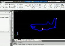
Extract An AutoCAD Civil 3D Surface Border To a 3D Polyline In this AutoCAD Civil 3D for Land Surveyors Video, you’ll learn how to extract an AutoCAD Civil 3D Surface Border.

LightSquared Causes Falcone’s Harbinger Hedge Fund 47% Loss in 2011
Falcone’s Harbinger Hedge Fund Lost 47% in 2011

Create AutoCAD Civil 3D Parcels From Objects Video
Create AutoCAD Civil 3D Parcels From Objects Video This AutoCAD Civil 3D for Land Surveyors Video shows you how to create AutoCAD Civil 3D Parcels from objects, like: Lines Curves Polylines Watch The Video

Create Survey Point Groups in AutoCAD Civil 3D Survey Databases Video
Create Survey Point Groups in AutoCAD Civil 3D Survey Databases In this AutoCAD Civil 3D for Land Surveyors Video, I show you how to Create Survey Point Groups in AutoCAD Civil 3D Survey Databases. Survey Point Groups allow you to filter, organize and more easily work with Survey Database Points in your AutoCAD Civil 3D…

AutoCAD Civil 3D Set Survey Databases Working Folder Video
AutoCAD Civil 3D Set Survey Databases Working Folder Video In this AutoCAD Civil 3D for Land Surveyors Video I will show you how to set the Survey Databases Working Folder. Watch the Video

Pending Home Sales Rise Again in November, Highest in a Year-and-a-Half
Pending Home Sales Rise Again in November, Highest in a Year-and-a-Half Washington, DC, December 29, 2011 Pending home sales continued to gain in November and reached the highest level in 19 months, according to the National Association of Realtors®. The Pending Home Sales Index,* a forward-looking indicator based on contract signings, increased 7.3 percent to 100.1…

NSPS Announces the Latest Certified Survey Technicians (CST) from Cycle III 2011
NSPS Announces the Latest Certified Survey Technicians (CSTs) from Cycle III (July, August, and September 2011) About the National Society of Professional Surveyors (NSPS) Certified Survey Technician certification program: “The National Society of Professional Surveyors (NSPS) sponsors a comprehensive national certification program for survey technicians. The program is recognized by the U.S. Department of Labor as part…

Professional Land Surveyor Weekly Roundup October 30, 2011
Professional Land Surveyor Weekly Roundup: Professional Land Surveyor Source Twitter Weekly Updates for 2011-10-30 Atlas Machinery Supply Ltd. Expands into the Construction Market with Leica Geosystems Canada Professional Land Surveyor Weekly Roundup October 23, 2011 Professional Land Surveyor Source Twitter Weekly Updates for 2011-10-23 NASA and Japan Release Improved Topographic Map of Earth Gatewing X100…

Gatewing X100 Product Video 2011
Here’s an informative video from Gatewing highlighting their Gatewing X100 product. About the Gatewing X100 From Gatewing: The X100 is the result of a thorough and multidisciplinary engineering process. It has been designed with two main goals in mind and with due consideration for the demanding field worker. It carries a camera payload, flies in…

Texas Society of Professional Surveyors (TSPS) 2011 Award Winners
Texas Society of Professional Surveyors Award Winners From 2011 Convention The 60th Texas Society of Professional Surveyors (TSPS) Convention & Technology Exposition was held on October 5-8 in Frisco, Texas. TSPS reported an attendance of about 750 total, with participation in: Educational Sessions The Tech Expo TSPS business meetings Social Events The Texas Society of Professional Surveyors…

New England Section ACSM Presents: Emerging Technologies in Surveying & Mapping Seminar
New England Section ACSM Presents Emerging Technologies in Surveying & Mapping Seminar October 15, 2011 The New England Section ACSM invites you to an Emerging Technologies in Surveying & Mapping Seminar presented by Claire Kiedrowski, ASPRS Certified Photo-grammetrist and President of KAPPA Mapping, Inc. located in Bangor, Maine. This Emerging Technologies in Surveying & Mapping Seminar will…

Professional Land Surveyor Weekly Roundup October 2, 2011
Professional Land Surveyor Weekly Roundup: Professional Land Surveyor Source Twitter Weekly Updates for 2011-10-02 Trimble’s Portfolio of Survey Solutions Allows Surveyors to Collect, Share and Deliver Data Faster to Improve Productivity Optech Announces New Airborne Laser Terrain Mappers (ALTM) Models: Orion M/C 300 Spectra Precision Introduces New ProMark 800 GNSS Receiver and Survey Pro 5.0…
Professional Land Surveyor Weekly Roundup September 18, 2011
Professional Land Surveyor Weekly Roundup: Professional Land Surveyor Source Twitter Weekly Updates for 2011-09-18 USGS Historical Topographic Map Collection Now Online Sokkia Releases NET-AX Series of Automated Total Stations for 3D Monitoring LightSquared Video to Debunk Several GPS Interference Myths-Facts or Propaganda? Defense Department Seeks to Protect GPS Operations Against LightSquared Network House Aviation Subcommittee…
Autodesk and Kelar Pacific Present Building Information Modeling (BIM) Business Best Practices at Executive Dinner in September
Leaders in BIM Software and Implementation Show Construction Decision Makers How to Use BIM as a Business Driver SAN DIEGO, Calif., September 6, 2011 Kelar Pacific, an Autodesk Gold Partner and Design and Consulting firm, will host an educational seminar, The Business of BIM Executive Dinner, for construction executives and decision makers interested in the Building Information…