Tag: TPS
-

Topcon Announces Direct Cloud-Link Between MAGNET Enterprise and AutoCAD WS
New capability streamlines the availability of critical field information onto mobile devices Topcon Positioning Systems, Inc., (TPS) a global leader in precision positioning technology, has announced the first results of its collaboration with Autodesk, Inc., a leader in 3D design, engineering and entertainment software: A direct link to AutoCAD WS within Topcon’s MAGNET™ Enterprise cloud…
-

Topcon Introduces PS-AS Robotic Total Station for Construction Industry
LIVERMORE, Calif. – January 10, 2013 – Topcon Positioning Systems (TPS) introduces a new series of robotic total stations specifically designed and configured for the construction market. The new instruments are designed for applications such as stakeout and as a key component of a Local Positioning System, which is used for 3D machine control.
-

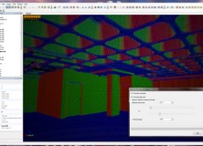
Topcon Releases ScanMaster CAD Link for GLS-1500
Topcon Releases ScanMaster CAD Link for GLS-1500 LIVERMORE, Calif. – November 27, 2012 – Topcon Positioning Systems (TPS) announces the release of ScanMaster CAD Link which provides users with an interactive link between ScanMaster and AutoCAD® software and enables efficient feature extraction and drawing of objects. CAD Link is an optional extension for ScanMaster software…
-

‘Topcon is Everywhere’ Photo Contest Launched
‘Topcon is Everywhere’ Photo Contest LIVERMORE, Calif. – July 13, 2012 – Topcon Positioning Systems (TPS) announces the “Topcon is Everywhere” photo contest – inviting participants from around the world to share a look at where and how Topcon products are being used. “Topcon is a global company and our equipment is ‘everywhere’ from high-accuracy…
-

Topcon Introduces The PN-A5 GNSS Antenna
Topcon introduces the PN-A5 GNSS antenna Innovative convex impedance ground plane, improved multipath mitigation LIVERMORE, Calif. – February 23, 2012 – Topcon Positioning Systems (TPS) announces the new PN-A5 GNSS antenna that combines the company’s TA-5 full spectrum GNSS antenna element with a newly designed semi-hemispherical convex impedance ground plane.
-
New Version of Topcon ScanMaster Software Improves Scanning Performance
New Version of Topcon ScanMaster Software Improves Scanning Performance LIVERMORE, Calif. – Thursday, October 27, 2011 Topcon Positioning Systems (TPS) has released a new version of software used with Topcon’s GLS series of laser scanners – ScanMaster v2.5. The new version was designed to improve existing features, add new functions, and broaden applications for scanning. “We’ve…
-

Topcon Announces Tesla Large Screen Data Collector
Topcon announces Tesla, large screen data collector New unit features advantages of tablet PC and handheld computer Topcon Positioning Systems (TPS) announces a new larger screen data collector – Topcon Tesla™ featuring the advantages of a tablet PC and a rugged handheld computer. The announcement was made at Intergeo in Nuremberg, Germany. Intergeo is the…
-

Professional Land Surveyor News-Leica Viva TS15-Robotic Imaging Total Station World Premiere at INTERGEO 2010
5 October 2010, (Heerbrugg/Cologne) Leica Geosystems is pleased to announce its new robotic Imaging Total Station, the Leica Viva TS15. This state-of-the-art total station provides advanced imaging functionality combined with dynamic tracking capabilities for one-person surveying. Furthermore, Leica Viva TS15 features the easy-to-use Leica SmartWorx Viva onboard software.