Tag: Template
-

AutoCAD Civil 3D 911 Edit Multiple Points
EMERGENCY AUTOCAD CIVIL 3D 911, HOW CAN WE HELP YOU? In this AutoCAD Civil 3D 911 series article is available to all site members beginning at the Associate Member level. Some names have been changed to protect the inquisitive. Submit your AutoCAD Civil 3D 911 request using the form at the end of this article. AutoCAD Civil 3D 911:…
-
AutoCAD Civil 3D 911 Create Curve From End of Object
EMERGENCY AUTOCAD CIVIL 3D 911, HOW CAN WE HELP YOU? In this AutoCAD Civil 3D 911 series article is available to all site members beginning at the Associate Member level. Some names have been changed to protect the inquisitive. Submit your AutoCAD Civil 3D 911 request using the form at the end of this article. AutoCAD Civil 3D 911:…
-
AutoCAD Civil 3D 911 Default Template File Name for QNEW
EMERGENCY AUTOCAD CIVIL 3D 911, HOW CAN WE HELP YOU? In this AutoCAD Civil 3D 911 series article is available to all site members beginning at the Associate Member level. Some names have been changed to protect the inquisitive. Submit your AutoCAD Civil 3D 911 request using the form at the end of this article. AutoCAD Civil 3D 911:…
-

AutoCAD Civil 3D Custom Template Setup & Training Done Right
A large organization asked me this week if I could give them AutoCAD Civil 3D custom template setup and training. They’re looking to use AutoCAD Civil 3D in their workflows. What struck me about their request is they recognized that a successful implementation of AutoCAD Civil 3D is more than simply setting up a template, and that training…
-
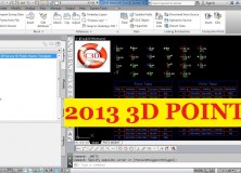
2013 AutoCAD Civil 3D Survey 3D Points Starter Template
I created the 2013 AutoCAD Civil 3D Survey 3D Points Starter Template(s) as a jumping-off point for land surveyors, or anyone using points in AutoCAD Civil 3D, to build their own custom template. The benefits of building from this template are many – saving you many hours of setup and frustrations – but here are…
-

AutoCAD Civil 3D Template Sale
AutoCAD Civil 3D 2011 and 2012 Templates Sale With the release of the first of our 2013 AutoCAD Civil 3D templates, we’re putting our 2011 and 2012 AutoCAD Civil 3D Template on sale. 25% Off 2012 AutoCAD Civil 3D Templates All of our 2012 AutoCAD Civil 3D are marked down by 25%. 2012 AutoCAD Civil 3D…
-

AutoCAD Civil 3D for Land Surveyors Coordinate Systems Refresher Video
In this oldie but goodie video, I show you how to set up coordinate systems in AutoCAD Civil 3D Drawings & Survey Databases. If you’re new to AutoCAD Civil 3D, properly setting up your Drawing and Survey Databases is the most important thing you need to do. While this video shows you how to set up…
-

Description Keys Are Unnecessary
Description Keys Are Unnecessary – There, I Said It! As soon as I first stated using AutoCAD Civil 3D, many moons ago, I had two thoughts: From a land surveyor’s point of view, AutoCAD Civil 3D was not as “revolutionary” a tool as it was/is for civil engineering software improvements (as well as being a financial…
-

AutoCAD Civil 3D 2012 Survey Essential Template Framework
Announcing New AutoCAD Civil 3D 2012 Survey Essential Template Framework This is a digital download product of an AutoCAD Civil 3D Template called AutoCAD Civil 3D 2012 Survey Essential Template Framework. My goal was to create an AutoCAD Civil 3D Template for those of you looking for an affordable base framework to build upon to…
-

5 AutoCAD Civil 3D Settings Professional Land Surveyors Need To Know
It’s frustrating as heck trying to learn how to setup and use AutoCAD Civil 3D and also get projects completed. You’re not a professional student; you’re a Professional Land Surveyor, Engineer, Designer, etc. Whatever you are, you’re trying to get the job done right and earn a living! Depending on what’s in your AutoCAD Civil…