Your cart is currently empty!
Tag: Scanning
Laser Scanning Drones: XactSense is First to Fly Velodyne’s New Low-Cost LIDAR “Puck”
XactSense Inc. has developed a new platform for low-altitude aerial mapping using the newly released Velodyne LIDAR VLP-16 “Puck”. Drone LIDAR mapping for the masses is here. Providence, Rhode Island (PRWEB) March 02, 2015 XactSense, Inc. has developed a new platform for low-altitude aerial mapping using the newly released Velodyne LIDAR VLP-16 “Puck”. Drone LIDAR…

Surveyor’s Saturday Serendipity: Center City, Pa Flythrough Using Pointools and 3ds Max
A wee bit of Surveyor’s Saturday Serendipity with a Laser Scanning Video by Control Point Associates described on their Youtube Channel as: “This is a unique flythrough using Pointools and 3ds Max to give a first person representation of an entire city block and the inside of a hallway. Control Point Associates” Watch the Surveyor’s Saturday Serendipity: Center…

Surveyor’s Saturday Serendipity: Mini-UAV-Based Photogrammetry and Laser Scanning Video
A wee bit of Surveyor’s Saturday Serendipity with a Mini-UAV-Based Photogrammetry and Laser Scanning Video. I love this technology, which could become an industry game-changer, allowing entry into the aerial mapping market to land surveying and geomatic companies. Watch the Surveyor’s Saturday Serendipity: Mini-UAV-Based Photogrammetry and Laser Scanning Video
Leica Geosystems Laser Scanning Video: Chapter 1 of 3 – The Basics
Laser Scanning: Chapter 1 of 3 – The Basics This professionally produced, educational HD video overview of 3D laser scanning includes film footage of its use in the field for scene capture and in the office for processing laser scans into deliverables such as drawings, models, etc.

Drombeg Stone Circle Laser Scanning Video
Animation of a laser scan survey of Drombeg Stone Circle, Glandore, Co.Cork. Surveyed using a Faro Focus 120 scanner by the Discovery Programme as part of the 3D-ICONS project. The animation, generated in Pointools shows the point cloud data rendered with the INTENSITY values which can improve the definition of features in the model.

Space Shuttle Endeavour LA Move – 3D Laser Scanning
Space Shuttle Endeavour LA Move – 3D Laser Scanning This video contains 3D mobile scanning animation for the Space Shuttle move.
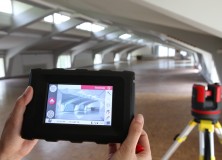
Leica 3D Disto – New Software Version 2.0 With Improved Functionality
Leica 3D Disto – New software version 2.0 with improved functionality Since more than one year, the Leica 3D Disto redefines the market for measurement tools. As being first in its category, the Leica 3D Disto is a unique tool for measurement and projection, leveling and easy scanning. The new software version 2.0 introduces new…

Integration of Laser Scanner Data & Mobile Mapping Data : Faro Focus 3D & Topcon IP-S2 Video
I’m just a sucker for a good laser scanning video, and here’s a new one. Watch the Integration of Laser Scanner Data & Mobile Mapping Data : Faro Focus 3D & Topcon IP-S2 Video
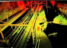
High-Definition Survey (HDS) Laser Scanning on Amtrak Video
High-Definition Survey (HDS) Laser Scanning on Amtrak Video “Chilton Engineering offers High-Definition Survey (HDS) laser scanning expertise on Amtrak corridor for City of Philadelphia Department of Streets bridge replacement project. Our efficient field survey delivered detailed data on catenary towers, horizontal and vertical track alignment, utilities, bridge cross-sections, abutments and more without disruption to rail…

UK Police Forces Embrace Leica Geosystems ScanStation C10 3D Laser Scanning
UK Police Forces Embrace Leica ScanStation C10 3D Laser Scanning 6 January 2012 (Milton Keynes, UK 5th January 2012) – Leica Geosystems is pleased to announce the largest ever order of Leica ScanStation C10’s as UK Police Forces embrace High Definition SurveyingTM (HDS). The scanners will be supplied as part of a £2.7 million investment from the Department…

Calvada Surveying Inc Offering High Definition 3D Laser Scanning Survey for Land
Calvada Surveying Inc Offering High Definition 3D Laser Scanning Survey for Land 3d Laser Scanning Services, boundary surveys, alta acsm land title survey, ALTA survey Corona, California – Calvada Surveying Inc., a pioneering land surveying firm is offering the most extensive state of the art technology popularly known as High-Definition (HDS), or 3D Laser scanning services.…

Optech Announces Rapid Mobilization Platform for Lynx Mobile Mapper
Optech Announces Rapid Mobilization Platform for Lynx Mobile Mapper Toronto, Canada, September 27, 2011 Optech Incorporated, the world’s leading manufacturer of advanced lidar and camera survey instruments, is pleased to announce a new lightweight, state-of-the-art mounting platform for its Lynx Mobile Mapper. The newly designed rack features rigid mounting points and latching that virtually eliminate…
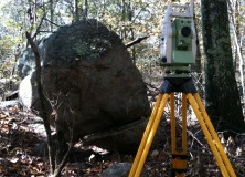
Professional Land Surveyor Weekly Roundup November 13, 2011
Professional Land Surveyor Weekly Roundup: Professional Land Surveyor Source Twitter Weekly Updates for 2011-11-13 Knowing Your Numbers-How to Develop Project Metrics for Your Land Surveying Company Leica Viva – SmartWorx Viva – Image Notes Video Professional Land Surveyor Weekly Roundup November 6, 2011 Professional Land Surveyor Source Twitter Weekly Updates for 2011-11-06 New TigerSupplies Showroom…
Professional Land Surveyor Weekly Roundup November 6, 2011
Professional Land Surveyor Weekly Roundup: Professional Land Surveyor Source Twitter Weekly Updates for 2011-11-06 New TigerSupplies Showroom for High-Quality Architectural, Engineering and Survey Equipment Soyuz Launched With First Two Geopositioning Galileo Satellites House Small Business Committee Ask the FCC to Halt Waiver on LightSquared Proposal Javad Ashjaee, GPS Pioneer and JAVAD Founder, Admits to GPS…
New Version of Topcon ScanMaster Software Improves Scanning Performance
New Version of Topcon ScanMaster Software Improves Scanning Performance LIVERMORE, Calif. – Thursday, October 27, 2011 Topcon Positioning Systems (TPS) has released a new version of software used with Topcon’s GLS series of laser scanners – ScanMaster v2.5. The new version was designed to improve existing features, add new functions, and broaden applications for scanning. “We’ve…

ClearEdge3D Wins Prestigious National Science Foundation Grant for Automated Feature Extraction Research
Funding will greatly improve the company’s feature extraction technology; goal is to virtually eliminate manual modeling of facilities, buildings and entire cities Herndon, Virginia — September 21, 2011 — ClearEdge3D today announced that it has won a research grant from the National Science Foundation (NSF) to further develop its technology in the rapidly evolving field of…
Plowman Craven Extends its 3D Laser Scanning Capability with the New HDS7000 Terrestrial Laser Scanning System from Leica Geosystems
6 September 2011 (Milton Keynes, UK 6 September 2011) – Already a proven leader in innovation, Plowman Craven has now procured one of the UK’s first Leica HDS7000 ultra high speed scanner to ensure the best combination of speed and accuracy for its measurement survey solutions. With scanning speeds of up to one million points per…
Laser Scanned Point Cloud of the USS Blueback Submarine Video
It’s short and sweet, but still an interesting video showing the use of laser scanned point clouds to scan the USS Blueback Submarine located at the Oregon Museum of Science and Industry (OMSI) in Portland, Oregon. Watch the Laser Scanned Point Cloud of the USS Blueback Submarine Video
Leica Cyclone 7.2 Improves Processing of Rich, “As-built” Point Clouds from Laser Scanning
29 July 2011 (Heerbrugg, 29 July 2011) – Leica Geosystems announces new Leica Cyclone v7.2 software that improves office processing and use of rich “as-built” point cloud data. Several innovations in Leica Cyclone 7.2 address key market needs and trends in the processing and use of rich, as-built point cloud data from laser scanning/High-Definition Surveying™. One…
Cool 3D Laser Scanning Video
Watch this cool 3D Pointcloud flythrough of a recent measured building Omegageomatics undertook of a historic listed building dating from the late 18th century.