Your cart is currently empty!
Tag: Polyline

AutoCAD Civil 3D Working With Images And Surfaces Professional Land Surveyor Learning Center Course
AutoCAD Civil 3D C3D-102 Working With Images And Surfaces Professional Land Surveyor Learning Center Course Now Available In this AutoCAD Civil 3D Professional Land Surveyor Learning Center (PLSLC) course, C3D-102 Working With Images And Surfaces, you will learn the best practices for working with Images and Surfaces when draping an Image over a Surface. What You Will…

AutoCAD Civil 3D How To Convert A 3D Polyline To A 2D Polyline Video
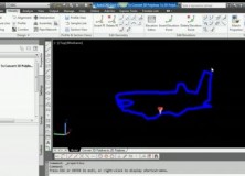
AutoCAD Civil 3D How To Convert A 3D Polyline To A 2D Polyline Video This AutoCAD Civil 3D for Land Surveyors Video shows you how to Convert a 3D Polyline to a 2D Polyline. Building on my last video, Extract AutoCAD Civil 3D Surface Border Video, I use the results of the steps shown in this…

Extract AutoCAD Civil 3D Surface Border Video
Extract An AutoCAD Civil 3D Surface Border To a 3D Polyline In this AutoCAD Civil 3D for Land Surveyors Video, you’ll learn how to extract an AutoCAD Civil 3D Surface Border.
Professional Land Surveyor News: AutoCAD Civil 3D 2011 Survey and API Hotfix
Professional Land Surveyor News: AutoCAD Civil 3D 2011 Survey and API Hotfix Autodesk has announced an update / hotfix for it’s AutoCAD Civil 3D 2011 product line. According to Autodesk, this update / hotfix address the following: In a continued effort to improve, we are releasing this hotfix for AutoCAD Civil 3D 2011 that addresses…
SYCODE Releases ESRI Shape File Import Plug-ins for AutoCAD, Bricscad, IntelliCAD and Rhinoceros
SYCODE Releases ESRI Shape File Import Plug-ins for AutoCAD, Bricscad, IntelliCAD and Rhinoceros Panaji, GOA – 28th October, 2009 – SYCODE has released ESRI Shape file import plug-ins for AutoCAD, Bricscad, IntelliCAD and Rhinoceros. The plug-ins will allow these CAD systems to read two dimensional geometric data from ESRI shape files. “Recently we noticed an increase in…