Your cart is currently empty!
Tag: Orthophoto

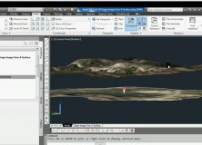
AutoCAD Civil 3D Drape Images Over A Surface Video
AutoCAD Civil 3D Drape Images Over A Surface Video This AutoCAD Civil 3D for Land Surveyors Video shows you how to drape Images over a Surface.

AutoCAD Civil 3D How To Trim Image to a Surface Border Video
AutoCAD Civil 3D How To Trim Image to a Surface Border This AutoCAD Civil 3D for Land Surveyors Video shows you how to trim an image, like a geo-referenced aerial photograph or orthophoto, to a Civil 3D Border.

AutoCAD Civil 3D How To Insert Geo-Referenced Images Video
AutoCAD Civil 3D How To Insert Geo-Referenced Images This AutoCAD Civil 3D for Land Surveyors Video shows you how to insert geo-referenced images, like aerial photographs or orthophotos. AutoCAD Civil 3D, being built on Map 3D, allows you to easily use Geographic Information System (GIS) data into your land surveying, design and engineering projects. All you…

Gatewing Introduces Stretchout UAV Desktop Processing
Gatewing Introduces Stretchout UAV Desktop Processing Ghent, Belgium – December 15, 2011 – Gatewing®, manufacturer of the revolutionary X100 unmanned aerial system (UAS) for mapping and surveying, introduces Gatewing Stretchout™, a breakthrough image processing solution which automatically converts your X100 image data to accurate orthophotos and DSMs. “With Gatewing Stretchout™ we’ve challenged the accepted way…
Vienna City Hall (Rathaus) Based on LIDAR Data, Orthophoto, Terrestial Images and Cadastral Map
Here’s a cool video of the Vienna City Hall (Rathaus) based on LIDAR data, Orthophoto, Terrestial images and Cadastral map. Nice music, too!
Professional Land Surveyor News: Leica XPro 4.3 – HiRes Ortho Processing Reduces Flight Lines and Increases Productivity
Professional Land Surveyor News: Leica XPro 4.3 – HiRes Ortho Processing Reduces Flight Lines and Increases Productivity Today, Leica Geosystems announced that their leading line sensor workflow, the Leica XPro, has been updated with new features. Leica XPro 4.3 – HiRes Ortho Processing provides advanced ground processing from data download to image generation and users of the…