Your cart is currently empty!
Tag: Model

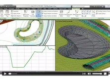
Learn How AutoCAD Civil 3D Can Help Extend The Value Of Your Model Video
Watch the video and learn how AutoCAD Civil 3D civil engineering software can help extend the value of your model. (2:42 min.)

GEOID12 Error Analysis Complete and GEOID12A Model Developed
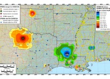
Here’s an important notice from The National Geodetic Survey (NGS) concerning the new GEOID12 model: The National Geodetic Survey has determined that the GEOID12 model was developed using erroneous input control points, primarily in the Gulf Coast region. NGS immediately corrected these errors and developed a replacement model: GEOID12A. GEOID12A is now available for public…

The National Geodetic Survey Improves the National Spatial Reference System with Simultaneous Major Product Releases
The National Geodetic Survey Improves the National Spatial Reference System with Simultaneous Major Product Releases In the first week of July, NOAA’s National Geodetic Survey (NGS) released the results of three major improvements to the National Spatial Reference System (NSRS). The NSRS is the consistent coordinate system that defines latitude, longitude, height, scale, gravity, and…

NGS Releases New Geoid Model to Serve Surveying, Engineering, and Scientific Communities
NGS Releases New Geoid Model to Serve Surveying, Engineering, and Scientific Communities In the last week, the National Geodetic Survey has released a new height transformation model for surveyors, engineers, and the scientific community involved in water flow and the determination of heights with respect to mean sea level. The new “GEOID12” model, implemented in…

Emergency AutoCAD Civil 3D 911: Where Did My Layout And Model Tabs Go?
EMERGENCY LAND SURVEYING 911, HOW CAN WE HELP YOU? In this AutoCAD Civil 3D 911 series article, some names have been changed to protect the inquisitive. Submit your AutoCAD Civil 3D 911 request using the form at the end of this article. AutoCAD Civil 3D 911: Where Did My Layout And Model Tabs Go? Julie Asks: I’m fairly new to…
AutoCAD Civil 3D Surveying Quick Tips and Tricks-How to Rotate Model Space
In today’s AutoCAD Civil 3D Surveying Quick Tips and Tricks I will show How to Rotate Model Space. This technique can help you to speed up your AutoCAD Civil 3D drawing by aligning your model space other than having north straight up. The Problem: By default, AutoCAD Civil 3D drawings are oriented with north pointing up. This sometimes…
Professional Land Surveyor News-Carlson Software’s 2011 Office Product Release
Professional Land Surveyor News-Carlson Software’s 2011 Office Product Release Hundreds of Improvements to Speed Work and Increase AccuracyHighlight Carlson Software’s 2011 Office Product Release MAYSVILLE, Ky., U.S.A. (September 30, 2010) — Carlson Software, a leading producer of software for land development professionals in the surveying, civil engineering, construction and mining industries, has released its 2011…
Eagle Point Software Corporation to Offer Compatible Solutions to AutoCAD Civil 3D 2011 Software
DUBUQUE, Iowa, April 20, 2010 – Eagle Point Software Corporation today announced it will offer compatible solutions to Autodesk’s AutoCAD Civil 3D 2011 software for the building design, infrastructure, and construction industries. “We are excited to be able to quickly support the AutoCAD Civil 3D 2011 release in our portfolio of add-on products that include Pinnacle…