Tag: Maps
-

Esri Releases National Geographic World Basemap
Highly Detailed Basemap Accessible via ArcGIS Online January 4, 2012 Redlands, California—In cooperation with National Geographic, Esri released the National Geographic World Map. Esri and National Geographic collaborated to produce a distinctive basemap that reflects National Geographic’s cartographic design, typographic style, and map policies. Designed to be aesthetically pleasing, the National Geographic World Map is…
-
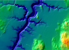
The National Land Survey of Finland Opens Topographic Datasets 1 May 2012 For Free Use
The National Land Survey of Finland Opens Topographic Datasets 1 May 2012 For Free Use The Ministry for Agriculture and Forestry issued a decree on 21 December 2011 on the fees of the National Land Survey of Finland (NLS). The decree prescribes that the NLS will open its topographic datasets to the public on 1…
-

Cartography: “The Mapmaking Process” pt3-3 1973 US Army Video
Cartography: “The Mapmaking Process” pt3-3 1973 US Army Part 3 of 3 of video from 1973 produced by the US Army on the mapmaking process. “EXPLAINS THE THEORY OF MAPMAKING, AND ILLUSTRATES THE METHODS AND TECHNIQUES USED TO PRODUCE MAPS; PLANNING, SURVEYING, COMPILING, AND REPRODUCTION.” US Army training film TF5-4523 Watch the Cartography: “The Mapmaking…
-
Cartography: “The Mapmaking Process” pt2-3 1973 US Army Video
Cartography: “The Mapmaking Process” pt2-3 1973 US Army Part 2 of 3 of video from 1973 produced by the US Army on the mapmaking process. “EXPLAINS THE THEORY OF MAPMAKING, AND ILLUSTRATES THE METHODS AND TECHNIQUES USED TO PRODUCE MAPS; PLANNING, SURVEYING, COMPILING, AND REPRODUCTION.” US Army training film TF5-4523 Watch the Cartography: “The Mapmaking…
-
Cartography: “The Mapmaking Process” pt1-3 1973 US Army Video
Cartography: “The Mapmaking Process” pt1-3 1973 US Army Really interesting video from 1973 produced by the US Army on the mapmaking process. “EXPLAINS THE THEORY OF MAPMAKING, AND ILLUSTRATES THE METHODS AND TECHNIQUES USED TO PRODUCE MAPS; PLANNING, SURVEYING, COMPILING, AND REPRODUCTION.” US Army training film TF5-4523 Watch the Cartography: “The Mapmaking Process” pt1-3 1973…
-

Trimble’s Kirkland to Discuss LightSquared Issue in MAPPS Winter Meeting Keynote Address
Trimble’s Kirkland to Discuss LightSquared Issue in MAPPS Winter Meeting Keynote Address MAPPS (www.mapps.org), the national association of private sector geospatial firms, today announced that Jim Kirkland, vice president and general counsel of Trimble and a leader in the effort to defend GPS users from interference by the LightSquared system proposal, will be the keynote…
-
Third Win for Kappa Mapping at National Geospatial Excellence Awards Program
Third Win for Kappa Mapping at National Geospatial Excellence Awards Program Bangor, ME – In November, Kappa Mapping took part in the fifth annual MAPPS Geospatial Products and Services Excellence Awards competition and won an award in the Small Projects category for the third consecutive year. Kappa’s winning entry – Innovative Software use for Danbury Airport (DXR)…
-

Gatewing Introduces Stretchout UAV Desktop Processing
Gatewing Introduces Stretchout UAV Desktop Processing Ghent, Belgium – December 15, 2011 – Gatewing®, manufacturer of the revolutionary X100 unmanned aerial system (UAS) for mapping and surveying, introduces Gatewing Stretchout™, a breakthrough image processing solution which automatically converts your X100 image data to accurate orthophotos and DSMs. “With Gatewing Stretchout™ we’ve challenged the accepted way…
-

The U.S. Geological Survey (USGS) Releases New Heights of Accuracy for World Topography
The U.S. Geological Survey (USGS) and the National Geospatial-Intelligence Agency (NGA) have collaborated in the development of a much improved global elevation model, the Global Multi-resolution Terrain Elevation Data 2010 (GMTED2010). GMTED2010 replaces the widely used, 15-year-old GTOPO30 terrain model as the best available global digital elevation model. Useful for regional-, continental-, and global-scale applications,…
-
Trimble Offers Custom Topographic, Aerial and Hybrid Map Prints
Trimble Offers Custom Topographic, Aerial and Hybrid Map Prints
-

Esri Press Book Presents Latest Crime Mapping and Analysis Methods
Esri Press Book Presents Latest Crime Mapping and Analysis Methods November 15, 2011 Redlands, California—GIS Tutorial for Crime Analysis, the new workbook from Esri Press, combines step-by-step tutorials with independent exercises to teach readers the skills needed to apply mapping and analysis to police work. Designed for both classroom instruction and self-study, the book includes…
-
Professional Land Surveyor Weekly Roundup October 30, 2011
Professional Land Surveyor Weekly Roundup: Professional Land Surveyor Source Twitter Weekly Updates for 2011-10-30 Atlas Machinery Supply Ltd. Expands into the Construction Market with Leica Geosystems Canada Professional Land Surveyor Weekly Roundup October 23, 2011 Professional Land Surveyor Source Twitter Weekly Updates for 2011-10-23 NASA and Japan Release Improved Topographic Map of Earth Gatewing X100…
-

NASA and Japan Release Improved Topographic Map of Earth
PASADENA, Calif. – NASA and Japan released a significantly improved version of the most complete digital topographic map of Earth on Monday, produced with detailed measurements from NASA’s Terra spacecraft. The map, known as a global digital elevation model, was created from images collected by the Japanese Advanced Spaceborne Thermal Emission and Reflection Radiometer, or…
-

Gatewing X100 Product Video 2011
Here’s an informative video from Gatewing highlighting their Gatewing X100 product. About the Gatewing X100 From Gatewing: The X100 is the result of a thorough and multidisciplinary engineering process. It has been designed with two main goals in mind and with due consideration for the demanding field worker. It carries a camera payload, flies in…
-

New Esri Basemap Highlights Thematic Content
Free Light Gray Canvas Basemap Service Now Available October 6, 2011 User data shown on top of Light Gray Canvas map is easier to distinguish compared to user data displayed on busier maps
-

New England Section ACSM Presents: Emerging Technologies in Surveying & Mapping Seminar
New England Section ACSM Presents Emerging Technologies in Surveying & Mapping Seminar October 15, 2011 The New England Section ACSM invites you to an Emerging Technologies in Surveying & Mapping Seminar presented by Claire Kiedrowski, ASPRS Certified Photo-grammetrist and President of KAPPA Mapping, Inc. located in Bangor, Maine. This Emerging Technologies in Surveying & Mapping Seminar will…