Your cart is currently empty!
Tag: Latest

Leica Geosystems Introduces The Latest Version 4.2 Of Its Leica Spider Software Suite For GNSS Networks and Reference Stations
Leica Geosystems introduces the latest version 4.2 of its Leica Spider Software Suite for GNSS Networks and Reference Stations Leica Geosystems is pleased to release the new version 4.2 of its market leading Leica Spider software suite. The globally used solution for GNSS RTK networks is being continually enhanced and developed following the market needs…

NSPS Announces the Latest Certified Survey Technicians (CST) from Cycle III 2011
NSPS Announces the Latest Certified Survey Technicians (CSTs) from Cycle III (July, August, and September 2011) About the National Society of Professional Surveyors (NSPS) Certified Survey Technician certification program: “The National Society of Professional Surveyors (NSPS) sponsors a comprehensive national certification program for survey technicians. The program is recognized by the U.S. Department of Labor as part…

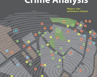
Esri Press Book Presents Latest Crime Mapping and Analysis Methods
Esri Press Book Presents Latest Crime Mapping and Analysis Methods November 15, 2011 Redlands, California—GIS Tutorial for Crime Analysis, the new workbook from Esri Press, combines step-by-step tutorials with independent exercises to teach readers the skills needed to apply mapping and analysis to police work. Designed for both classroom instruction and self-study, the book includes…