Your cart is currently empty!
Tag: Images

AutoCAD Civil 3D Working With Images And Surfaces Professional Land Surveyor Learning Center Course
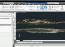
AutoCAD Civil 3D C3D-102 Working With Images And Surfaces Professional Land Surveyor Learning Center Course Now Available In this AutoCAD Civil 3D Professional Land Surveyor Learning Center (PLSLC) course, C3D-102 Working With Images And Surfaces, you will learn the best practices for working with Images and Surfaces when draping an Image over a Surface. What You Will…

The Professional Land Surveyor Podcast Episode 4
The Professional Land Surveyor Podcast (PLSP) Shownotes – Episode 4

Professional Land Surveyor Weekly Roundup April 1, 2012
Professional Land Surveyor Weekly Roundup: AutoCAD Civil 3D 2012 and 2013 System Requirements Compared Side By Side Working With Images And Surfaces Premium Video AutoCAD Civil 3D 2013 System Requirements AutoCAD Civil 3D Drape Images Over A Surface Video Professional Land Surveyor Weekly Roundup March 25, 2012 Professional Land Surveyor Premium Post Updates How To…

Working With Images And Surfaces Premium Video
Premium AutoCAD Civil 3D for Land Surveyors half hour Video series shows you the best practices for working with Images and Surfaces when draping an Image over a Surface. You can either buy this at our store or get it as a free Premium Members download: Buy the Working With Images And Surfaces Video ($21) Premium…

AutoCAD Civil 3D Drape Images Over A Surface Video
AutoCAD Civil 3D Drape Images Over A Surface Video This AutoCAD Civil 3D for Land Surveyors Video shows you how to drape Images over a Surface.

AutoCAD Civil 3D How To Trim Image to a Surface Border Video
AutoCAD Civil 3D How To Trim Image to a Surface Border This AutoCAD Civil 3D for Land Surveyors Video shows you how to trim an image, like a geo-referenced aerial photograph or orthophoto, to a Civil 3D Border.

Professional Land Surveyor Weekly Roundup March 4, 2012
Professional Land Surveyor Weekly Roundup: What Is The Major Challenge Facing Professional Land Surveyors Today? 3 Tools to Get Your Professional Land Surveying Business Paid Faster AutoCAD Civil 3D How To Insert Geo-Referenced Images Video New Leica Digicat 600i and 650i For Safe and Fast Location of Underground Services Professional Land Surveyor Weekly Roundup February…

AutoCAD Civil 3D How To Insert Geo-Referenced Images Video
AutoCAD Civil 3D How To Insert Geo-Referenced Images This AutoCAD Civil 3D for Land Surveyors Video shows you how to insert geo-referenced images, like aerial photographs or orthophotos. AutoCAD Civil 3D, being built on Map 3D, allows you to easily use Geographic Information System (GIS) data into your land surveying, design and engineering projects. All you…
XYGO Maps Chile’s Major Cities with Topcon Positioning Systems (TPS) IP-S2 LiDAR
XYGO, based in Santiago, Chile, is using Topcon Positioning Systems’ (TPS) IP-S2 to map all of central Chile’s main cities with LiDAR. The IP-S2 is a vehicle-mounted system with three laser scanners and a multi-lens digital camera. Data collection can be performed at normal roadway travel speeds as the system collects millions of LiDAR points…
Vienna City Hall (Rathaus) Based on LIDAR Data, Orthophoto, Terrestial Images and Cadastral Map
Here’s a cool video of the Vienna City Hall (Rathaus) based on LIDAR data, Orthophoto, Terrestial images and Cadastral map. Nice music, too!
Professional Land Surveyor News Trimble Introduces New Desktop and GPS Handheld Solution for Utility and Smart Grid Asset Maintenance and Inspection
Professional Land Surveyor News Trimble Introduces New Desktop and GPS Handheld Solution for Utility and Smart Grid Asset Maintenance and Inspection SAN DIEGO, July 12, 2010 — Trimble (NASDAQ:TRMB) introduced today a new version of its Trimble® Field Inspector solution for utility infrastructure and smart grid asset maintenance and inspection. The solution is comprised of…
Professional Land Surveyor News: First China-Made Unmanned Aerial Photography Systems Delivered
Professional Land Surveyor News: First China-Made Unmanned Aerial Photography Systems Delivered People’s Daily Online reports that on April 15 the first batch of 17 light, fixed-wing unmanned aerial vehicle (UAV) aerial photography systems was delivered in Beijing, China to the surveying and mapping departments of 16 provinces and municipalities. Chinese surveying and mapping departments have…
Professional Land Surveyor News: GeoTagging is Illegal in China
Professional Land Surveyor News: GeoTagging is Illegal in China Today I found this interesting article by Expert Reviews, which reveals that the Communist China Government has made GeoTagging illegal. This is a fascinating story and union of two unlikely pairings – a camera review and surveying in China. It seems that Expert Reviews was, well, doing an…
Professional Land Surveyor News: Trimble Introduces Indoor Mobile Mapping Solution for Capturing Interior Spaces in 2D and 3D Visualization Models
Trimble Introduces Indoor Mobile Mapping Solution for Capturing Interior Spaces in 2D and 3D Visualization Models Delivers Rapid, Easy and High-productivity Indoor Mapping HOUSTON, Feb. 8, 2010 — Trimble (NASDAQ: TRMB) introduced today an indoor mobile mapping solution for facilities management. Using innovative technologies, the solution produces fast and accurate maps allowing users to translate their…
Professional Land Surveyor Survey Party: A Few Land Surveying Pictures From The Field
This Professional Land Surveyor Survey Party is brought to you by EricColburn.com – Professional Land Surveyor Source – showing a few pictures I snapped while carrying out land surveying field work somewhat recently. Most of these pictures were taken within the last few weeks, which you might be able to tell by the snow and/or stark…
AutoCAD Civil 3D Surveying Quick Tips and Tricks: Image Edit and Frames
More AutoCAD Civil 3D Surveying Help! I get more questions about AutoCAD Civil 3D than I do on any other subject. The complexity of the program coupled with the myriad of settings required to make it a useful piece of surveying and design software results in it being very tricky to set up and use.…