Your cart is currently empty!
Tag: HDS

Merrick & Company Wins First Place in the Leica Geosystems Civil/Survey Category of the “High Definition Surveying (HDS) Plan” Contest
SURVEY TEAM RECEIVES 1ST PLACE COLORADO – Merrick & Company won first place in the civil/survey category of the “High Definition Surveying (HDS) Plan” contest, hosted by Leica Geosystems. The annual event is part of a worldwide conference, Hexagon 2012. The awards program allows Leica HDS/laser scanning users to submit posters with laser scanning deliverables in…

High-Definition Survey (HDS) Laser Scanning on Amtrak Video
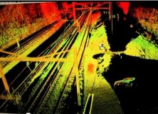
High-Definition Survey (HDS) Laser Scanning on Amtrak Video “Chilton Engineering offers High-Definition Survey (HDS) laser scanning expertise on Amtrak corridor for City of Philadelphia Department of Streets bridge replacement project. Our efficient field survey delivered detailed data on catenary towers, horizontal and vertical track alignment, utilities, bridge cross-sections, abutments and more without disruption to rail…

UK Police Forces Embrace Leica Geosystems ScanStation C10 3D Laser Scanning
UK Police Forces Embrace Leica ScanStation C10 3D Laser Scanning 6 January 2012 (Milton Keynes, UK 5th January 2012) – Leica Geosystems is pleased to announce the largest ever order of Leica ScanStation C10’s as UK Police Forces embrace High Definition SurveyingTM (HDS). The scanners will be supplied as part of a £2.7 million investment from the Department…

Calvada Surveying Inc Offering High Definition 3D Laser Scanning Survey for Land
Calvada Surveying Inc Offering High Definition 3D Laser Scanning Survey for Land 3d Laser Scanning Services, boundary surveys, alta acsm land title survey, ALTA survey Corona, California – Calvada Surveying Inc., a pioneering land surveying firm is offering the most extensive state of the art technology popularly known as High-Definition (HDS), or 3D Laser scanning services.…
Leading VFX Data Capture Company 4DMax Invest in the Latest Leica High-Definition Surveying Technology
UK based 4DMax, a leading company in the film, TV, visual FX and Forensic 3D data capture market has recently purchased the latest Leica High-Definition SurveyingTM (HDS) ScanStation C10 to enhance its 3D data capture services. Duncan Lees, Co-Owner and Director, 4DMax comments: “Working across a number of markets from big Hollywood blockbuster movies such…
Leica Geosystems Announces New HDS7000 Ultra High-Speed, Phase Scanner
11 April 2011 Leica Geosystems Announces New HDS7000 Ultra High-Speed, Phase Scanner (Norcross, GA April 2011) Leica Geosystems announces the HDS7000, a new phase-based laser scanner that lets users take advantage of ultra-high speed scanning for more scanning applications on more sites. The HDS7000 features key enhancements over its predecessor thanks to its rugged design, excellent…
Professional Land Surveyor News: Leica Geosystems and MicroSurvey Extend Software Partnership
Leica Geosystems and MicroSurvey Extend Software Partnership (Houston, 8 February 2010) Based on rapid growth of High-Definition Surveying™ (HDS™) in civil/survey mapping applications, Leica Geosystems, the market leader in laser scanning products, and MicroSurvey Software Inc., a leader in mapping software, announced plans at SPAR 2010 for Leica Geosystems to resell MicroSurvey’s new PointCloud CAD mapping…
New Leica ScanStation C10 Gives Surveyors a Competitive Edge with High-Definition Laser Scanning
New Leica ScanStation C10 Gives Surveyors a Competitive Edge with High-Definition Laser Scanning September 1, 2009 — Leica Geosystems introduced today its fastest and most versatile laser scanning system, the Leica ScanStation C10. This new High-Definition Surveying™ (HDS™) scanner is designed to increase surveying productivity and accuracy in both routine surveys and large, complex projects.…