Your cart is currently empty!
Tag: Features
Topcon Unveils New Features for MAGNET Enterprise
iOS mobile application and new project manager extensions introduced Topcon Positioning Group announces two new updates for MAGNET® Enterprise – the cloud-based solution for managing field and office data in a web browser environment. New to the system is the introduction of MAGNET Enterprise Mobile, an application for mobile devices, as well as new…
Sokkia Announces New DX-200 Expands Robotic Working Range, Features Hybrid Versatility
New DX-200 Expands Robotic Working Range, Features Hybrid Versatility OLATHE, Kan. – January 31, 2014 – Sokkia Corporation announces enhanced abilities and versatility to its DX series of total stations with the introduction of the DX-200 in the North American market.

Professional Land Surveyor Weekly Roundup October 9, 2011
Professional Land Surveyor Weekly Roundup: Professional Land Surveyor Source Twitter Weekly Updates for 2011-10-09 Knowing Your Numbers-Project Metrics for Your Land Surveying Company LightSquared CEO on The Communicators Senator Chuck Grassley Continues to Pursue Information on LightSquared, Agency Interaction Elgin & Knowles-The U.S. Public Land Survey System (PLSS) for Arkansas Reference Book and Manual New…

Leica SmartWorx Viva v4.0 for Viva Total Station and Viva GNSS with Exciting New Features
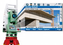
Leica SmartWorx Viva v4.0 for Viva Total Station and Viva GNSS with exciting new features 4 October 2011 (Norcross, GA Oct 4, 2011) – Leica Geosystems is pleased to announce version 4.0 of the easy-to-use Leica SmartWorx Viva onboard software being available in November 2011. This new version is packed with exciting new features to make…
Sokkia SHC236 Data Collector Packed with Features
Sokkia’s SHC236 Data Collector Packed with Features Olathe, Kan., – August 4, 2011 – Sokkia Corporation’s SHC236 is designed with advanced technology features for handheld data collection. Ed Castelan, product marketing manager for survey products, said, “The SHC236 is a powerful handheld data collector with all the features needed to compete in today’s market.”
AutoCAD Civil 3D Surveying Topics: Creating a New Description Key Set
In today’s AutoCAD Civil 3D Surveying Topics, I’d like to discuss how to create a Description Key Set. This is the second in a series of Premium Posts about description keys. In this post I’ll show you how to create Description Keys Sets and where to find your Description Key Sets for land surveying using AutoCAD…
AutoCAD Civil 3D Surveying Topics-What to do Before Creating a New Description Key Set
In today’s AutoCAD Civil 3D Surveying Topics, I’d like to discuss what to do before creating a Description Key Set. This is the first in a series of Premium Posts about description keys. I’ll start here with what to do before creating a new Description Key Set, then move on to how to setup Description…
Professional Land Surveyor News-Spectra Precision Introduces Additions to its Optical Survey Solutions and New Field Software Features
Professional Land Surveyor News-Spectra Precision Introduces Additions to its Optical Survey Solutions and New Field Software Features COLOGNE, Germany, Oct. 5, 2010 — Spectra Precision introduced today several additions to the Spectra Precision® FOCUS® 30 line of optical survey solutions and new features for the Spectra Precision Survey Pro™ field software. The announcement was made…
Professional Land Surveyor News: Topcon DL-500 Digital Level Series With First ‘Wave-and-Read’ Technology
Professional Land Surveyor News: Topcon DL-500 Digital Level Series With First ‘Wave-and-Read’ Technology Topcon Positioning Systems (TPS) announced this week that they’ve released their new DL-500 digital levels series, which uses digital ‘Wave-and-Read’ Technology for the very first time. Of course we’ve had optical ‘Wave-and-Read’ technology for eons – it’s called an instrument person looking…
5 Nice Features of AutoCAD Civil 3D 2010 Parcels
5 Nice Features of AutoCAD Civil 3D 2010 Parcels I was recently working on converting an older AutoCAD drawing to an AutoCAD Civil 3D 2010 drawing in order to modify a parcel and add a few new parcels to it. Also recently, I’ve been writing a soon to be released article about whether or not…
Professional Land Surveyor Source News – AutoCAD Civil 3D 2010 Update 2 is now Available
AutoCAD Civil 3D 2010 Update 2 Yesterday Autodesk released the second update to their AutoCAD Civil 3D 2010 software program. Clicking the link below will redirect you to the AutoCAD Civil 3D & AutoCAD Civil Services & Support page for the AutoCAD Civil 2010 Update 2. “In a continuing effort to provide high quality products, Autodesk…
AutoCAD Civil 3D 2010 Update 1
AutoCAD Civil 3D 2010 Update 1 Last Friday, July 31, 2009, Autodesk released the first update to their AutoCAD Civil 3D 2010. Clicking to the above link, you will find the update c3d2010sp1.exe, a readme file (which I recommend you do) and the following overview: In a continuing effort to provide high quality products, Autodesk…