Tag: ESRI
-

New Build of ArcGIS Explorer Desktop Tightens Integration with ArcGIS Online
Easier Sharing, Attribute Table Display, and New Presentation Tools Are Among Improvements The most recent ArcGIS Explorer Desktop release includes new features and enhancements to make it a more powerful tool in an enterprise GIS, including content sharing via ArcGIS Online, tabular information display, and new presentation tools. ArcGIS Explorer Desktop is a free GIS viewer that…
-

ArcGIS for AutoCAD Offers Advanced CAD and GIS Interoperability
New Version Introduces Geodatabase Editing August 22, 2012 Redlands, California—The latest release of ArcGIS for AutoCAD, Esri’s free AutoCAD plug-in, improves the ability to exchange data and information between the ArcGIS and AutoCAD platforms. ArcGIS for AutoCAD users with read/write access to ArcGIS for Server feature services can now edit geodatabases through AutoCAD. This enables…
-

Survey Summit 2012, The Road Ahead … or Summit Plummet?
I’ve just read that only an estimated 250 attended the joint endeavor between ESRI and the American Congress on Surveying and Mapping (ACSM) in San Diego last month, billed as the ACSM Annual Conference. Survey Summit or Summit Plummet? 250. That’s it! …. Survey Summit or Summit Plummet? With less than 5 attendees from each state,…
-

Esri GPS Base Station Joins National Continuously Operating Reference Station (CORS) Network
Real-Time, Precise Data Will Serve Professionals in the Redlands Community Redlands, California—Esri recently installed a GPS base station to assist its GIS developers and to support surveyors, engineers, scientists, and those in public works and public safety in the community surrounding the Esri campus in Redlands, California. The base station, named GISA, has been accepted…
-
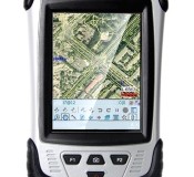
CHC Releases the LT30 GPS/GIS Handheld Collector
CHC Releases the LT30 GPS/GIS Handheld Collector Shanghai, China – (April 2nd, 2012) – CHC’s new LT30 series enters the GIS data collection market with a cost-effective, rugged and connected GPS/GIS handheld collector for a wide range of applications such as natural resources, forestry, utilities, agriculture, emergency response… Designed for real outdoor conditions, LT30 combines superb brightness…
-

Premier Conference for Surveyors, Engineers, and Mapping Professionals Returns to San Diego
The Survey Summit to Focus on New and Emerging Technologies January 18, 2012 Redlands, California— For the second consecutive year, the American Congress on Surveying and Mapping (ACSM) will join forces with Esri to host the premier event in the surveying industry. The Survey Summit will take place July 21–24, 2012, in San Diego, California, sharing its final…
-
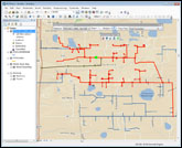
New Century Software Releases Geometric Network Synchronizer
Operators using PODS gathering systems & complex transmission pipeline systems can now automatically keep multiple geometric networks synchronized Fort Collins, CO. January 11, 2011. New Century Software (http://www.newcenturysoftware.com) announces the release of its new product, Geometric Network Synchronizer. Geometric Network Synchronizer is both an Esri ArcMap extension and a server component that builds and maintains…
-
Esri ELA Supports Maryland’s Nationally Recognized GIS Program
ArcGIS Software Empowers Agencies to Deliver Transparency and Accountability January 4, 2012 Redlands, California—The State of Maryland has acquired an Esri enterprise license agreement (ELA) that provides unlimited access to ArcGIS software to staff in its agencies. Under Governor Martin O’Malley’s leadership, the state uses GIS for much of its work including groundbreaking transparency and…
-

Esri Releases National Geographic World Basemap
Highly Detailed Basemap Accessible via ArcGIS Online January 4, 2012 Redlands, California—In cooperation with National Geographic, Esri released the National Geographic World Map. Esri and National Geographic collaborated to produce a distinctive basemap that reflects National Geographic’s cartographic design, typographic style, and map policies. Designed to be aesthetically pleasing, the National Geographic World Map is…
-

ArcGIS Online Overview Video
Create, find, use, and share maps, applications, and tools with everyone. Watch this ESRI ArcGIS Online Overview Video
-

Professional Land Surveyor Weekly Roundup November 27, 2011
Professional Land Surveyor Weekly Roundup: AutoCAD Civil 3D 2012 Update 1 Professional Land Surveyor Weekly Roundup November 20, 2011 Professional Land Surveyor Source Twitter Weekly Updates for 2011-11-20 Leica Viva GNSS Video Geographic and Land Information Society Board Votes to Continue GLIS as a Separate Organization Trimble Offers Custom Topographic, Aerial and Hybrid Map Prints…
-

Professional Land Surveyor Weekly Roundup November 20, 2011
Professional Land Surveyor Weekly Roundup: Professional Land Surveyor Source Twitter Weekly Updates for 2011-11-20 Leica Viva GNSS Video Geographic and Land Information Society Board Votes to Continue GLIS as a Separate Organization Trimble Offers Custom Topographic, Aerial and Hybrid Map Prints Esri Press Book Presents Latest Crime Mapping and Analysis Methods NSPS and ACSM Action…
-

Esri Press Book Presents Latest Crime Mapping and Analysis Methods
Esri Press Book Presents Latest Crime Mapping and Analysis Methods November 15, 2011 Redlands, California—GIS Tutorial for Crime Analysis, the new workbook from Esri Press, combines step-by-step tutorials with independent exercises to teach readers the skills needed to apply mapping and analysis to police work. Designed for both classroom instruction and self-study, the book includes…
-

GeoDesign Summit Promotes Practical Applications
Redlands, California—GIS and design professionals, academics, and developers will gather at Esri headquarters in Redlands, California, January 5–6, 2012, for the third annual GeoDesign Summit. The event is open to anyone interested in the field of GeoDesign, which integrates GIS-based spatial analysis into the design process. This year’s theme, GeoDesign in Practice, reflects a focus on…
-

Professional Land Surveyor Weekly Roundup October 9, 2011
Professional Land Surveyor Weekly Roundup: Professional Land Surveyor Source Twitter Weekly Updates for 2011-10-09 Knowing Your Numbers-Project Metrics for Your Land Surveying Company LightSquared CEO on The Communicators Senator Chuck Grassley Continues to Pursue Information on LightSquared, Agency Interaction Elgin & Knowles-The U.S. Public Land Survey System (PLSS) for Arkansas Reference Book and Manual New…
-

New Esri Basemap Highlights Thematic Content
Free Light Gray Canvas Basemap Service Now Available October 6, 2011 User data shown on top of Light Gray Canvas map is easier to distinguish compared to user data displayed on busier maps