Your cart is currently empty!
Tag: computer-aided design
-

Create Alignment From Objects in AutoCAD Civil 3D Video
Create Alignment From Objects in AutoCAD Civil 3D Video This AutoCAD Civil 3D for Land Surveyors Video shows you how to create an Alignment from Objects in AutoCAD Civil 3D. Watch the Create Alignment From Objects in AutoCAD Civil 3D Video
-

AutoCAD Civil 3D 2013 Manual Point Creation Video
AutoCAD Civil 3D 2013 Manual Point Creation Video This AutoCAD Civil 3D for Land Surveyors Video shows you how to do Manual Point Creation. Watch the AutoCAD Civil 3D 2013 Manual Point Creation Video
-

AutoCAD Civil 3D 2013 Add Viewport Scales Video
AutoCAD Civil 3D 2013 Add Viewport Scales Video This AutoCAD Civil 3D for Land Surveyors Video shows you how to Add Viewport Scales in Paperspace. Creating custom Viewport Scales is easy, once you know how. Watch the AutoCAD Civil 3D 2013 Add Viewport Scales Video
-

AutoCAD Civil 3D Filedia Command Video
AutoCAD Civil 3D Filedia Command Video This AutoCAD Civil 3D for Land Surveyors Video shows you how to use the FILEDIA command. I believe this command works for all flavors of AutoCAD. The FILEDIA command controls the file dialog boxes, turning them either on or off, like those used when opening and saving drawings. Sometimes,…
-

AutoCAD Civil 3D 2013 Paste Surfaces Using The Ribbon Video
AutoCAD Civil 3D 2013 Paste Surfaces Using The Ribbon Video This AutoCAD Civil 3D for Land Surveyors Video is an update to my last video (AutoCAD Civil 3D 2013 Paste Surfaces Video – see link below), in which, I forgot to show you how to paste surfaces using the Ribbon in AutoCAD Civil 3D. You…
-

AutoCAD Civil 3D 2013 Paste Surfaces Video
AutoCAD Civil 3D 2013 Paste Surfaces Video In this AutoCAD Civil 3D for Land Surveyors Video, I show you how to paste surfaces in AutoCAD Civil 3D. You can use this technique to merge design and/or as-built surfaces into your original existing conditions surface. Once you paste the surfaces into the first surface, you will…
-
AutoCAD Civil 3D 2013 Survey Hotfix Video
Get It While It’s Hot, New AutoCAD Civil 3D 2013 Survey Hotfix! Well, it didn’t take long for a software bug and an AutoCAD Civil 3D survey hotfix. “This hotfix resolves an issue with the Survey Figures Property Dialog. In the lower section of the panel you can now see the vertex properties for chain type…
-
AutoCAD Civil 3D 2013 Guts Google Earth
Surprise, Surprise, Surprise … Autodesk Guts Google Earth From AutoCAD Civil 3D 2013 In working with the newly released AutoCAD Civil 3D 2013, it surprised me to find out that Autodesk gutted Google Earth functionality from this latest C3D version. After not finding the formerly available Google Earth commands in the Import Panel on the Ribbon Insert…
-

AutoCAD Civil 3D 2013 Unwrapped Video
AutoCAD Civil 3D 2013 Unwrapped Video AutoCAD Civil 3D2013 Unwrapped video shows you a few new features of AutoCAD Civil 3D 2013.
-
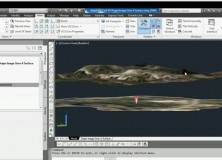
AutoCAD Civil 3D Drape Images Over A Surface Video
AutoCAD Civil 3D Drape Images Over A Surface Video This AutoCAD Civil 3D for Land Surveyors Video shows you how to drape Images over a Surface.
-

AutoCAD Civil 3D How To Trim Image to a Surface Border Video
AutoCAD Civil 3D How To Trim Image to a Surface Border This AutoCAD Civil 3D for Land Surveyors Video shows you how to trim an image, like a geo-referenced aerial photograph or orthophoto, to a Civil 3D Border.
-

AutoCAD Civil 3D How To Insert Geo-Referenced Images Video
AutoCAD Civil 3D How To Insert Geo-Referenced Images This AutoCAD Civil 3D for Land Surveyors Video shows you how to insert geo-referenced images, like aerial photographs or orthophotos. AutoCAD Civil 3D, being built on Map 3D, allows you to easily use Geographic Information System (GIS) data into your land surveying, design and engineering projects. All you…
-
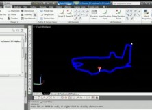
AutoCAD Civil 3D How To Convert A 3D Polyline To A 2D Polyline Video
AutoCAD Civil 3D How To Convert A 3D Polyline To A 2D Polyline Video This AutoCAD Civil 3D for Land Surveyors Video shows you how to Convert a 3D Polyline to a 2D Polyline. Building on my last video, Extract AutoCAD Civil 3D Surface Border Video, I use the results of the steps shown in this…
-

Extract AutoCAD Civil 3D Surface Border Video
Extract An AutoCAD Civil 3D Surface Border To a 3D Polyline In this AutoCAD Civil 3D for Land Surveyors Video, you’ll learn how to extract an AutoCAD Civil 3D Surface Border.