Tag: Available
-

National Geodetic Survey (NGS) Online Map of Corbin’s New LiDAR Evaluation Site Available
Online Map of Corbin’s New LiDAR Evaluation Site Available In December, a permanent airborne Light Detection and Ranging (LiDAR) test and evaluation site was installed at the National Geodetic Survey (NGS) Instrumentation & Methodologies Branch facility located in Corbin, Virginia.
-
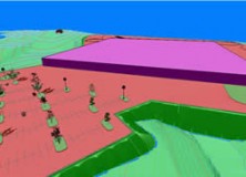
Carlson Survey 2012 Embedded AutoCAD Now Available
Carlson Survey 2012 Embedded AutoCAD® Now Available MAYSVILLE, Kentucky, U.S.A. — Carlson Survey 2012 Embedded AutoCAD®, Carlson’s feature-rich, intuitive surveying office software with the AutoCAD engine built in, has just been released. Among the top improvements in the affordable Carlson Survey 2012 Embedded AutoCAD version is increased 3D visualization, new 3D coding in its industry-renowned field-to-finish,…
-

Carlson SurvCE Data Collection Software Now Available with Leica Viva CS10 and CS15
Carlson SurvCE Data Collection Software Now Available with the Leica Viva (Norcrosss, GA October 2011) All versions of Carlson SurvCE 2.56 and later now have updated drivers and feature sets available to work on the Leica CS10 and CS15, Field Controllers. “We think this will be a very popular combination,” says Bruce Carlson, president of…