Your cart is currently empty!
Tag: Analysis
-

NGS Developing GIS Tools and Datasets for Display and Analysis of Survey Data
NGS Developing GIS Tools and Datasets for Display and Analysis of Survey Data NOAA’s National Geodetic Survey (NGS) is in the process of developing new Geographic Information System (GIS) software tools for display and analysis of NGS survey data.
-
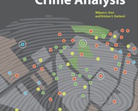
Esri Press Book Presents Latest Crime Mapping and Analysis Methods
Esri Press Book Presents Latest Crime Mapping and Analysis Methods November 15, 2011 Redlands, California—GIS Tutorial for Crime Analysis, the new workbook from Esri Press, combines step-by-step tutorials with independent exercises to teach readers the skills needed to apply mapping and analysis to police work. Designed for both classroom instruction and self-study, the book includes…