Your cart is currently empty!
Tag: Aerial Photographs
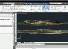
AutoCAD Civil 3D Drape Images Over A Surface Video
AutoCAD Civil 3D Drape Images Over A Surface Video This AutoCAD Civil 3D for Land Surveyors Video shows you how to drape Images over a Surface.

AutoCAD Civil 3D How To Trim Image to a Surface Border Video
AutoCAD Civil 3D How To Trim Image to a Surface Border This AutoCAD Civil 3D for Land Surveyors Video shows you how to trim an image, like a geo-referenced aerial photograph or orthophoto, to a Civil 3D Border.

AutoCAD Civil 3D How To Insert Geo-Referenced Images Video
AutoCAD Civil 3D How To Insert Geo-Referenced Images This AutoCAD Civil 3D for Land Surveyors Video shows you how to insert geo-referenced images, like aerial photographs or orthophotos. AutoCAD Civil 3D, being built on Map 3D, allows you to easily use Geographic Information System (GIS) data into your land surveying, design and engineering projects. All you…

Trimble Offers Custom Topographic, Aerial and Hybrid Map Prints
Trimble Offers Custom Topographic, Aerial and Hybrid Map Prints