Category: AutoCAD
-

NASA and Autodesk Collaborate on Sustainable Building Performance Monitoring
New Agreement to Advance Development of Technology to Monitor and Visualize Building Performance using Building Information Models
-

Surveyor’s Saturday Serendipity: Jay Leno’s Garage Faro 3D Laser Scanner Video
A wee bit of Surveyor’s Saturday Serendipity with a Jay Leno’s Garage: Faro 3D Laser Scanner video, for your watching pleasure. In this video you’ll find three very familiar names, and maybe one new one: Faro Laser Scanning Autodesk Jay Leno Geomagic Software And, believe it or not, this isn’t even the video highlight: Watch while…
-

Autodesk University 2012: What if? -Carl Bass on new Products and Services from Autodesk Video
Autodesk University 2012: What if? -Carl Bass on new Products and Services from Autodesk Video “During AU Virtual 2012 General Session broadcasting , Carl Bass showcased projects and services that will be available in the next year. Carl explained the Autodesk position regarding the cloud technology, integrate in the Autodesk product portfolio.” Professional Land Surveyor…
-

Autodesk University 2012: Virtual Interface Video
If you are unable to attend Autodesk University 2012, checkout Autodesk University 2012: Virtual Autodesk University 2012: Virtual Interface Video
-

MicroSurvey Releases EmbeddedCAD 2013
MicroSurvey® Releases embeddedCAD 2013 October 4th, 2012 – MicroSurvey is pleased to announce a major update to MicroSurvey embeddedCAD, a standalone application that is Powered with Autodesk Technology™ and contains the MicroSurvey suite of enhanced tools for land surveyors.
-
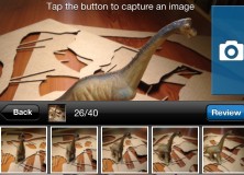
Autodesk 123D Catch for iPhone Lets Everyone Create 3D Printed Models with Photos
App Expands on iOS to include iPhone SAN FRANCISCO–(BUSINESS WIRE)–Autodesk, Inc. launched the new free* Autodesk 123D Catch app for iPhone on the App Store. Complementing the iPad, desktop and web app versions, the app lets users take photos from their camera on iPhone and upload them to the cloud where the photos are converted…
-

Eagle Point Support for 2013 Versions of AutoCAD Civil 3D and Autodesk Revit Solutions Now Available
Support for 2013 Versions of AutoCAD Civil 3D and Autodesk Revit Solutions Now Available DUBUQUE, Iowa, September 4, 2012 – Eagle Point Software Corporation, an Autodesk AEC Industry Partner, announced the addition of AutoCAD Civil 3D 2013 and Autodesk Revit 2013 resources to Pinnacle Series, which enables AEC organizations to immediately take advantage of the new…
-
Autodesk Profits Fall and Lays Off 520 Employees
Autodesk stumbled this week, missing its earning expectations, cutting its full-year sales growth forecast, stocks taking a beating, and then laying off 520 employees, being 7% of their total staff. Got Recession? It seems that the uber-techno-giant Autodesk is also feeling the recession-that-went-on-too-long-blues. Can you believe that Autodesk has got recession, too? Particularly considering their low-cost…
-

ArcGIS for AutoCAD Offers Advanced CAD and GIS Interoperability
New Version Introduces Geodatabase Editing August 22, 2012 Redlands, California—The latest release of ArcGIS for AutoCAD, Esri’s free AutoCAD plug-in, improves the ability to exchange data and information between the ArcGIS and AutoCAD platforms. ArcGIS for AutoCAD users with read/write access to ArcGIS for Server feature services can now edit geodatabases through AutoCAD. This enables…
-
Autodesk Expands Educational Offerings with 2013 Design and Creation Suites
Autodesk Expands Educational Offerings with 2013 Design and Creation Suites SAN RAFAEL, Calif.–(BUSINESS WIRE)–Autodesk, Inc. (NASDAQ:ADSK) announced the company’s 2013 comprehensive offering of software, cloud services and curriculum for secondary, postsecondary and vocational educational institutions. The 2013 offering includes access to the latest design and creation software suites and curricula, including specific suites for education, which…
-

AutoCAD Civil 3D Filedia Command Video
AutoCAD Civil 3D Filedia Command Video This AutoCAD Civil 3D for Land Surveyors Video shows you how to use the FILEDIA command. I believe this command works for all flavors of AutoCAD. The FILEDIA command controls the file dialog boxes, turning them either on or off, like those used when opening and saving drawings. Sometimes,…
-

Professional Land Surveyor Weekly Roundup April 1, 2012
Professional Land Surveyor Weekly Roundup: AutoCAD Civil 3D 2012 and 2013 System Requirements Compared Side By Side Working With Images And Surfaces Premium Video AutoCAD Civil 3D 2013 System Requirements AutoCAD Civil 3D Drape Images Over A Surface Video Professional Land Surveyor Weekly Roundup March 25, 2012 Professional Land Surveyor Premium Post Updates How To…
-

AutoCAD Civil 3D How To Insert Geo-Referenced Images Video
AutoCAD Civil 3D How To Insert Geo-Referenced Images This AutoCAD Civil 3D for Land Surveyors Video shows you how to insert geo-referenced images, like aerial photographs or orthophotos. AutoCAD Civil 3D, being built on Map 3D, allows you to easily use Geographic Information System (GIS) data into your land surveying, design and engineering projects. All you…
-
AutoCAD Civil 3D How To Convert A 3D Polyline To A 2D Polyline Video
AutoCAD Civil 3D How To Convert A 3D Polyline To A 2D Polyline Video This AutoCAD Civil 3D for Land Surveyors Video shows you how to Convert a 3D Polyline to a 2D Polyline. Building on my last video, Extract AutoCAD Civil 3D Surface Border Video, I use the results of the steps shown in this…
-
Autodesk Technology Makeover Contest for Small Businesses
Call for Entries: Autodesk Technology Makeover Contest for Small Businesses Small businesses can gain competitive edge with new software and hardware. –(BUSINESS WIRE)–Autodesk, Inc.: WHAT: An Autodesk software technology makeover for AutoCAD® customers using outdated software and hardware is ready to help small businesses gain or enhance competitive advantage. A new contest will award up…
-
Autodesk 2012 Content Explorer Service Hot Fix 2
Autodesk 2012 Content Explorer Service Hot Fix 2 Here’s an AutoCAD 2012 hot fix which will fix issues you might be experiencing with Autodesk 2012 Content Explorer. Autodesk 2012 Content Explorer Service Hot Fix 2 This hotfix applies to the Autodesk 2012 Content Explorer Service (Public and Personal) and addresses the following issues: In some cases…
-

Professional Land Surveyor Weekly Roundup January 1, 2012
Professional Land Surveyor Weekly Roundup: ArcGIS Online Overview Video Video-Has The Land Surveying Industry Let You Down? Carlson Takeoff R5 Speeds Up Converting PDF Files & Much More Trimble’s Kirkland to Discuss LightSquared Issue in MAPPS Winter Meeting Keynote Address 4 Ingredients for a Successful Professional Land Surveyor Business Web Presence Professional Land Surveyor Survey-Has…
-

Professional Land Surveyor Weekly Roundup December 25, 2011
Professional Land Surveyor Weekly Roundup: Professional Land Surveyor Weekly Roundup December 25, 2011 Video Overview of AutoCAD Civil 3D CHC Introduces New Cost-Effective GNSS X900 Receiver Carlson Survey 2012 Embedded AutoCAD Now Available New Outlook Report Forecasts Rise in Investment in Equipment and Software in 2012 Professional Land Surveyor Weekly Roundup December 18, 2011 LightSquared…
-

Video Overview of AutoCAD Civil 3D
An Overview of AutoCAD Civil 3D Watch as Kevin Breslin shows you how AutoCAD Civil 3D’s building information modeling can be used in a sample project — including: Import of survey data. Use of the intelligent modeling features. A good primer for those looking to learn about Civil 3D.