Category: Orthophotos
FAA Grants Real Estate, Agricultural UAS Exemptions
January 6– The Federal Aviation Administration today granted two regulatory exemptions for unmanned aircraft systems (UAS) operations, including the first for real estate photography. The agency gave the exemptions to Douglas Trudeau with Tierra Antigua Realty in Tucson, AZ, and Advanced Aviation Solutions in Spokane, WA. Before these exemption approvals, the FAA had granted 12…
Busting Myth #4 About The FAA and Unmanned Aircraft
The Federal Aviation Administration (FAA) published a list Busting Myths about the FAA and Unmanned Aircraft to discuss misconceptions and misinformation about Unmanned Aircraft System (UAS) regulations. As UAS, Unmanned Aerial Vehicles (UAV) or drones, if you will, become ever more popular for recreational and eventual commercial use, I thought it would be helpful to share…
Busting Myth #3 About The FAA and Unmanned Aircraft
The Federal Aviation Administration (FAA) published a list Busting Myths about the FAA and Unmanned Aircraft to discuss misconceptions and misinformation about Unmanned Aircraft System (UAS) regulations. As UAS, Unmanned Aerial Vehicles (UAV) or drones, if you will, become ever more popular for recreational and eventual commercial use, I thought it would be helpful to share…
Busting Myth #2 About The FAA and Unmanned Aircraft
The Federal Aviation Administration (FAA) published a list Busting Myths about the FAA and Unmanned Aircraft to discuss misconceptions and misinformation about Unmanned Aircraft System (UAS) regulations. As UAS, Unmanned Aerial Vehicles (UAV) or drones, if you will, become ever more popular for recreational and eventual commercial use, I thought it would be helpful to share…

Surveyor’s Saturday Serendipity: Mini-UAV-Based Photogrammetry and Laser Scanning Video
A wee bit of Surveyor’s Saturday Serendipity with a Mini-UAV-Based Photogrammetry and Laser Scanning Video. I love this technology, which could become an industry game-changer, allowing entry into the aerial mapping market to land surveying and geomatic companies. Watch the Surveyor’s Saturday Serendipity: Mini-UAV-Based Photogrammetry and Laser Scanning Video

Surveyor’s Saturday Serendipity: Drones for Aerial Surveying+EPIC Launcher!
A wee bit of Surveyor’s Saturday Serendipity of aerial surveying with an EPIC launcher!. Come fly with me, let’s fly, let’s fly away……

Agricultural Telematics Solution from Leica Geosystems
(Heerbrugg, Switzerland/Brisbane, Australia, 21 January 2013) – Today Leica Geosystems has launched Virtual VistaTM, a webbased platform which allows farmers to monitor their fleet and field activities in a simple and effective way. Virtual VistaTM connects directly through the built-in modem of the Leica mojo3D and customers can access the service within a few steps. No extra…

PCI Geomatics-Geomatica 2013 Beta Software Released
Geomatica 2013 Beta Software Released RICHMOND HILL, Ontario, Canada—July 10, 2012: PCI Geomatics, a world-leading developer of geoimaging software and systems, announced today that it has successfully launched the beta version of its desktop software, Geomatica 2013. The commercial release of Geomatica 2013 will build upon PCI’s successful Geomatica 2012 product, which was launched last…

Leica Geosystems Announces Leica RCD30 Multi-Head Camera Concept
Leica Geosystems announces Leica RCD30 multi-head camera concept (Heerbrugg, 6 June 2012) – Leica Geosystems, the world’s leading manufacturer of airborne mapping solutions, announced today that it is expanding the very popular Leica RCD30 series of medium format cameras by adding dual-head and penta-head solutions to the portfolio. The Leica RCD30 combines unique design features such…

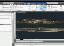
AutoCAD Civil 3D Drape Images Over A Surface Video
AutoCAD Civil 3D Drape Images Over A Surface Video This AutoCAD Civil 3D for Land Surveyors Video shows you how to drape Images over a Surface.

Professional Land Surveyor Weekly Roundup January 22, 2012
Professional Land Surveyor Weekly Roundup: AutoCAD Civil 3D Set Survey Databases Working Folder Video MicroSurvey Software Acquired by Hexagon LizardTech Releases Free GeoViewer Application for iPad Premier Conference for Surveyors, Engineers, and Mapping Professionals Returns to San Diego Sokkia CX Total Station Series Sets New Standard for Performance and Security Professional Land Surveyor Weekly Roundup…

LizardTech Releases Free GeoViewer Application for iPad
MrSID files now viewable on mobile devices for consumers SEATTLE, Wash. – January 18, 2012 – LizardTech®, a provider of software solutions for managing and distributing geospatial content, announced the release of a free GeoViewer application for iPad designed to view geospatial imagery and vector overlays. The free GeoViewer application enables users to view data stored on…

The National Land Survey of Finland Opens Topographic Datasets 1 May 2012 For Free Use
The National Land Survey of Finland Opens Topographic Datasets 1 May 2012 For Free Use The Ministry for Agriculture and Forestry issued a decree on 21 December 2011 on the fees of the National Land Survey of Finland (NLS). The decree prescribes that the NLS will open its topographic datasets to the public on 1…

GeoEye Wins Multi-year, Multi-million Dollar Russian Contract
GeoEye and ScanEx to Provide High-resolution Satellite Data for Russia’s Countrywide Cadastral Project HERNDON, Va., Jan. 4, 2012 /PRNewswire/ — GeoEye, Inc. (NASDAQ: GEOY), a leading source of geospatial information and insight, announced that it is working with its Russian partner, ScanEx Research and Development Center, to provide millions of square kilometers of high-resolution satellite…

Gatewing Introduces Stretchout UAV Desktop Processing
Gatewing Introduces Stretchout UAV Desktop Processing Ghent, Belgium – December 15, 2011 – Gatewing®, manufacturer of the revolutionary X100 unmanned aerial system (UAS) for mapping and surveying, introduces Gatewing Stretchout™, a breakthrough image processing solution which automatically converts your X100 image data to accurate orthophotos and DSMs. “With Gatewing Stretchout™ we’ve challenged the accepted way…

Professional Land Surveyor Weekly Roundup October 30, 2011
Professional Land Surveyor Weekly Roundup: Professional Land Surveyor Source Twitter Weekly Updates for 2011-10-30 Atlas Machinery Supply Ltd. Expands into the Construction Market with Leica Geosystems Canada Professional Land Surveyor Weekly Roundup October 23, 2011 Professional Land Surveyor Source Twitter Weekly Updates for 2011-10-23 NASA and Japan Release Improved Topographic Map of Earth Gatewing X100…

Gatewing X100 Product Video 2011
Here’s an informative video from Gatewing highlighting their Gatewing X100 product. About the Gatewing X100 From Gatewing: The X100 is the result of a thorough and multidisciplinary engineering process. It has been designed with two main goals in mind and with due consideration for the demanding field worker. It carries a camera payload, flies in…
PCI Geomatics Releases Next Generation of Flagship Geomatica Software Suite
Automation. Performance. Innovation. Geomatica 2012 enables geospatial professionals to solve real-world problems faster and more cost-effectively. RICHMOND HILL, Ontario, Canada—September 15, 2011: PCI Geomatics, a world leading developer of geo-imaging software and systems, today announces the release of Geomatica 2012; the latest version of the company’s complete and integrated desktop image processing software featuring tools…
Trimble’s New 80 Megapixel Aerial Camera Extends the Medium-Format Application Range
STUTTGART, Germany, Sept. 6, 2011 — Trimble (NASDAQ: TRMB) announced today its 80 megapixel Trimble Aerial Camera (TAC 80MP), extending the range of applications for today’s medium-format aerial cameras. The announcement was made at Photogrammetric Week. With advanced features such as Trimble’s forward motion compensation (FMC) technology, the TAC 80MP allows aerial service providers to…
Gatewing X100 Light Unmanned Aircraft Remote Sensing Solution
This video shows the Gatewing X100, an unmanned aircraft for aerial terrain mapping, in action. So much of the technology we use in land surveying and mapping is bleeding edge, technology gee whiz wonderment, so you’d think that we’ve seen it all and there’s nothing left to knock our socks off – And then comes…