Your cart is currently empty!
Category: Laser Scanning
Geospatial Social Media Recap April 25, 2015
Here are a few of the more interesting or amusing (at least to me) surveying, mapping, geomatics, technology and other generally geospatial related social media updates from around the interwebs (with occasional tangents). Geospatial updates more fun than a barrel full of monkeys… monkeys with maps that is. (Click to Tweet) Terrane Aerial Mapping via…
Geov8 2015 Virtual Expo Announced by Colburn Strategic Partners for August 15, 2015
An Online Virtual Geoinnovation Event Showcasing New and Innovative Geospatial Technology 04/12/2015 – The Geov8 2015 Virtual Expo is an online virtual geoinnovation event showcasing new and innovative geospatial technologies. This event will be held by Colburn Strategic Partners, experts in geospatial technology integration. There will be industry leaders and specialists in geospatial tech presenting…
Laser Scanning Drones: XactSense is First to Fly Velodyne’s New Low-Cost LIDAR “Puck”
XactSense Inc. has developed a new platform for low-altitude aerial mapping using the newly released Velodyne LIDAR VLP-16 “Puck”. Drone LIDAR mapping for the masses is here. Providence, Rhode Island (PRWEB) March 02, 2015 XactSense, Inc. has developed a new platform for low-altitude aerial mapping using the newly released Velodyne LIDAR VLP-16 “Puck”. Drone LIDAR…
FARO Launches New X Series Laser Scanner: The Focus3D X 130
Lake Mary, FL – FARO Technologies, Inc. (NASDAQ: FARO), the world’s most trusted source for 3D measurement, imaging and realization technology, announced the release of the new FARO Laser Scanner Focus3D X 130. The Focus3D X 130, the newest member of Focus3D X Series range of laser scanners, delivers tremendous power, compact design, and the…
3D Laser Scanning with GRP 5000 Video
“Fast, precise and easy 3D laser scanning. Amberg Technologies system solution for absolute (3D) clearance surveying provides unique, comprehensive, 3D environment surveying, track geometry and clearance envelope management.” Professional Land Surveyor Source: AmbergTechnologies
Professional Surveyor Interview with Brad Adams-Leica Geosystems Pegasus:One System
Dave Doyle from Professional Surveyor Magazine interviews Brad Adams about the brand new Leica Geosystems Pegasus:One mobile mapping system in this video. Watch the Professional Surveyor Interview with Brad Adams – Leica Geosystems, Pegasus 1 System Video
New Leica MultiWorx for AutoCAD: Easy Creation of Survey Deliverables from Laser Scanning and Imaging with the New Leica Nova MS50 MultiStation
(Heerbrugg, Switzerland/Las Vegas,USA, 5 June 2013) – Leica Geosystems’ new Leica Nova MS50 MultiStation, announced at HxGN Live, enables surveyors to easily perform 3D laser scanning tasks and work with point clouds in 3D. To help newcomers to laser scanning take full advantage of the system’s capabilities, Leica Geosystems announces Leica MultiWorx for AutoCAD, an easy-to-learn…
ZEB1 Hand Held Mapping System Used to Explore Aboriginal Caves
ZEB1, the world’s first truly mobile handheld rapid laser mapping system has been used to explore Aboriginal cave markings in South Australia. The strange markings, called finger flutings, were thought to have been left in the Koonalda Cave between about 30,000 and 10,000 years ago.

Surveyor’s Saturday Serendipity: Center City, Pa Flythrough Using Pointools and 3ds Max
A wee bit of Surveyor’s Saturday Serendipity with a Laser Scanning Video by Control Point Associates described on their Youtube Channel as: “This is a unique flythrough using Pointools and 3ds Max to give a first person representation of an entire city block and the inside of a hallway. Control Point Associates” Watch the Surveyor’s Saturday Serendipity: Center…

Surveyor’s Saturday Serendipity: Mini-UAV-Based Photogrammetry and Laser Scanning Video
A wee bit of Surveyor’s Saturday Serendipity with a Mini-UAV-Based Photogrammetry and Laser Scanning Video. I love this technology, which could become an industry game-changer, allowing entry into the aerial mapping market to land surveying and geomatic companies. Watch the Surveyor’s Saturday Serendipity: Mini-UAV-Based Photogrammetry and Laser Scanning Video

Leica Geosystems Laser Scanning Video: Chapter 1 of 3 – The Basics
Laser Scanning: Chapter 1 of 3 – The Basics This professionally produced, educational HD video overview of 3D laser scanning includes film footage of its use in the field for scene capture and in the office for processing laser scans into deliverables such as drawings, models, etc.

Surveyor’s Saturday Serendipity: Jay Leno’s Garage Faro 3D Laser Scanner Video
A wee bit of Surveyor’s Saturday Serendipity with a Jay Leno’s Garage: Faro 3D Laser Scanner video, for your watching pleasure. In this video you’ll find three very familiar names, and maybe one new one: Faro Laser Scanning Autodesk Jay Leno Geomagic Software And, believe it or not, this isn’t even the video highlight: Watch while…

National Geodetic Survey (NGS) Online Map of Corbin’s New LiDAR Evaluation Site Available
Online Map of Corbin’s New LiDAR Evaluation Site Available In December, a permanent airborne Light Detection and Ranging (LiDAR) test and evaluation site was installed at the National Geodetic Survey (NGS) Instrumentation & Methodologies Branch facility located in Corbin, Virginia.

Topcon Releases ScanMaster CAD Link for GLS-1500
Topcon Releases ScanMaster CAD Link for GLS-1500 LIVERMORE, Calif. – November 27, 2012 – Topcon Positioning Systems (TPS) announces the release of ScanMaster CAD Link which provides users with an interactive link between ScanMaster and AutoCAD® software and enables efficient feature extraction and drawing of objects. CAD Link is an optional extension for ScanMaster software…

Merrick & Company Wins First Place in the Leica Geosystems Civil/Survey Category of the “High Definition Surveying (HDS) Plan” Contest
SURVEY TEAM RECEIVES 1ST PLACE COLORADO – Merrick & Company won first place in the civil/survey category of the “High Definition Surveying (HDS) Plan” contest, hosted by Leica Geosystems. The annual event is part of a worldwide conference, Hexagon 2012. The awards program allows Leica HDS/laser scanning users to submit posters with laser scanning deliverables in…

Drombeg Stone Circle Laser Scanning Video
Animation of a laser scan survey of Drombeg Stone Circle, Glandore, Co.Cork. Surveyed using a Faro Focus 120 scanner by the Discovery Programme as part of the 3D-ICONS project. The animation, generated in Pointools shows the point cloud data rendered with the INTENSITY values which can improve the definition of features in the model.

Leica ScanStation P20: Three World’s Firsts in a Ultra-High Speed Laser Scanner to Deliver Unprecedented 3D Point Quality and Productivity
Leica ScanStation P20: Three World’s Firsts in a Ultra-High Speed Laser Scanner to Deliver Unprecedented 3D Point Quality and Productivity (Heerbrugg/Switzerland and Hanover/Germany, 9th October 2012) – Leica Geosystems today announces the Leica ScanStation P20, bringing unprecedented performance to ultra-high speed laser scanning. Developed and manufactured by industry pioneer and leader, the Leica ScanStation P20 provides…

Space Shuttle Endeavour LA Move – 3D Laser Scanning
Space Shuttle Endeavour LA Move – 3D Laser Scanning This video contains 3D mobile scanning animation for the Space Shuttle move.

Topcon IP-S2 Compact+ 3D Mobile Mapping System for a Wide Range of Applications
Topcon IP-S2 Compact+ 3D mobile mapping system for a wide range of applications LIVERMORE, Calif. – October 11, 2012 – Topcon Positioning System (TPS) introduces the new IP-S2 Compact+, an innovative mobile mapping system to accurately measure objects even in adverse weather conditions and enclosed job sites such as tunnels and mines.

Leica 3D Disto – New Software Version 2.0 With Improved Functionality
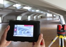
Leica 3D Disto – New software version 2.0 with improved functionality Since more than one year, the Leica 3D Disto redefines the market for measurement tools. As being first in its category, the Leica 3D Disto is a unique tool for measurement and projection, leveling and easy scanning. The new software version 2.0 introduces new…