Your cart is currently empty!
Category: Leica
SmartNet North America Releases New Tools for Improved GNSS Productivity
NORCROSS, GA, – SmartNet North America (www.smartnetna.com), the high-precision, high-availability network RTK correction service, has released a number of new tools to improve GNSS productivity and support, including additional support tools, online Rover Error Logs, and a RINEX Project Tool. With the launch of the new SmartNet Portal last year, SmartNet added a completely new…
Professional Surveyor Interview with Brad Adams-Leica Geosystems Pegasus:One System
Dave Doyle from Professional Surveyor Magazine interviews Brad Adams about the brand new Leica Geosystems Pegasus:One mobile mapping system in this video. Watch the Professional Surveyor Interview with Brad Adams – Leica Geosystems, Pegasus 1 System Video
Leica Zeno GIS: Simplified Positioning With 3rd Party Applications
(Heerbrugg, Switzerland, 16 May 2013) – Leica Geosystems’ latest version of Zeno Connect supports the output of local grid coordinates in addition to the already supported output of WGS84 coordinates. The output of local grid coordinates allows Leica Zeno GIS users who have installed a 3rd party GIS application to benefit from Leica Geosystems’ high-precision projection…
Leica GR25 WLAN-Enabled GNSS Reference Server Provides Unique Internet Sharing
(Heerbrugg, Switzerland, 8 May 2013) – The Leica GR25 GNSS Reference Server has now been enhanced with a standard on-board WLAN module to extend its Ethernet and mobile wireless internet connectivity options. This is accompanied by the new RefWorx on-board firmware v3.00, adding unique internet connection sharing allowing other computers or network devices connected to Ethernet or…

Leica iCON Introduces New ‘Roading’ Application and Major Productivity Gains with Updated iCONstruct v1.5 Field Software
Leica iCON Introduces New ‘Roading’ Application and Major Productivity Gains with Updated iCONstruct v1.5 Field Software Leica Geosystems has released a new, enhanced version of the iCONstruct field software for its pioneering Leica iCON portfolio of tailor-made positioning and measuring solutions for construction professionals. iCONstruct field v1.5 significantly improves and further optimizes construction workflow efficiency…

Leica Geosystems Laser Scanning Video: Chapter 1 of 3 – The Basics
Laser Scanning: Chapter 1 of 3 – The Basics This professionally produced, educational HD video overview of 3D laser scanning includes film footage of its use in the field for scene capture and in the office for processing laser scans into deliverables such as drawings, models, etc.

Agricultural Telematics Solution from Leica Geosystems
(Heerbrugg, Switzerland/Brisbane, Australia, 21 January 2013) – Today Leica Geosystems has launched Virtual VistaTM, a webbased platform which allows farmers to monitor their fleet and field activities in a simple and effective way. Virtual VistaTM connects directly through the built-in modem of the Leica mojo3D and customers can access the service within a few steps. No extra…

Now available: Leica CS25 GNSS Tablet Computer with Integrated GNSS for Any Asset Collection & Management Task
Now available: Leica CS25 GNSS Tablet Computer with Integrated GNSS for Any Asset Collection & Management Task (Heerbrugg/Switzerland, 10 December 2012) – The Leica CS25 GNSS Tablet Computer packs full GNSS functionality into an ergonomic and portable device with a large screen, making it the industry’s most powerful GNSS/GIS handheld. The CS25 GNSS doesn’t require a…

Leica 3D Disto Wins “Performance and Innovation” Award at EquipBaie Trade Fair
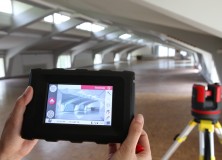
(Heerbrugg/Switzerland, 6 December 2012) – The Leica 3D Disto won the Performance and Innovation Award at the recent EquipBaie trade fair in Paris. This revolutionary tool is able to measure, scan or project to any location in a room independent from a room’s geometry or around a building in three dimensions while visualizing and documenting…

Merrick & Company Wins First Place in the Leica Geosystems Civil/Survey Category of the “High Definition Surveying (HDS) Plan” Contest
SURVEY TEAM RECEIVES 1ST PLACE COLORADO – Merrick & Company won first place in the civil/survey category of the “High Definition Surveying (HDS) Plan” contest, hosted by Leica Geosystems. The annual event is part of a worldwide conference, Hexagon 2012. The awards program allows Leica HDS/laser scanning users to submit posters with laser scanning deliverables in…

Leica ScanStation P20: Three World’s Firsts in a Ultra-High Speed Laser Scanner to Deliver Unprecedented 3D Point Quality and Productivity
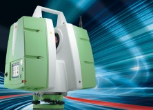
Leica ScanStation P20: Three World’s Firsts in a Ultra-High Speed Laser Scanner to Deliver Unprecedented 3D Point Quality and Productivity (Heerbrugg/Switzerland and Hanover/Germany, 9th October 2012) – Leica Geosystems today announces the Leica ScanStation P20, bringing unprecedented performance to ultra-high speed laser scanning. Developed and manufactured by industry pioneer and leader, the Leica ScanStation P20 provides…

Leica 3D Disto – New Software Version 2.0 With Improved Functionality
Leica 3D Disto – New software version 2.0 with improved functionality Since more than one year, the Leica 3D Disto redefines the market for measurement tools. As being first in its category, the Leica 3D Disto is a unique tool for measurement and projection, leveling and easy scanning. The new software version 2.0 introduces new…

PROTECT by Leica Geosystems: Best-in-Class Warranty and Service Offerings For the Construction Product Portfolio
PROTECT by Leica Geosystems: Best-in-Class Warranty and Service Offerings For the Construction Product Portfolio (Heerbrugg/Switzerland, 28 August 2012) – Leica Geosystems, worldwide leading premium manufacturer of surveying instruments and measurement tools, is pleased to announce Protect by Leica Geosystems, the new and unique warranty and service package for the entire Leica Geosystems construction product portfolio. Worldwide recognized for…

Leica Viva GS08plus – Lightest Cable-Free High-Accuracy GNSS System
Leica Viva GS08plus – Lightest cable-free high-accuracy GNSS system (Heerbrugg/Switzerland, 31 July 2012) – Leica Geosystems is pleased to announce a new GNSS solution to its successful Viva GNSS family. The Leica Viva GS08plus is the smallest and lightest cable-free high-accuracy GNSS system. Being light weight and ideally balanced, the Leica Viva GS08plus delivers ergonomic…

DMK Associates Brings Leica ScanStation C5 Scanner to SW Florida
Regional leader DMK Associates Inc. chooses a Leica Geosystems ScanStation C5 scanner to equip Southwest Florida’s first permanently-based laser scanning crew. (Norcross, Ga./Heerbrugg, 2 July 2012) – DMK Associates, Inc., a 28-person full-service consulting firm serving counties and municipalities in Southwest Florida, recently established the region’s first dedicated laser scanning crew and chose the Leica ScanStation…

Leica Geosystems Announces Leica RCD30 Multi-Head Camera Concept
Leica Geosystems announces Leica RCD30 multi-head camera concept (Heerbrugg, 6 June 2012) – Leica Geosystems, the world’s leading manufacturer of airborne mapping solutions, announced today that it is expanding the very popular Leica RCD30 series of medium format cameras by adding dual-head and penta-head solutions to the portfolio. The Leica RCD30 combines unique design features such…

Leica Zeno GIS: Leica Geosystems Enhances Its CS25 Tablet Computer Portfolio with Long Range Bluetooth
(Heerbrugg, 3 May 2012) – Leica Geosystems is pleased to announce the Leica CS25 LRBT, the new model of its successful Leica CS25 rugged tablet computer. The Leica CS25 LRBT offers the possibility to wirelessly connect to a remote device, such as a Leica Geosystems Total Station. The fully integrated data transfer via a Long Range Bluetooth® Wireless Technology…

Leica Geosystems Introduces The Latest Version 4.2 Of Its Leica Spider Software Suite For GNSS Networks and Reference Stations
Leica Geosystems introduces the latest version 4.2 of its Leica Spider Software Suite for GNSS Networks and Reference Stations Leica Geosystems is pleased to release the new version 4.2 of its market leading Leica Spider software suite. The globally used solution for GNSS RTK networks is being continually enhanced and developed following the market needs…

Professional Land Surveyor Weekly Roundup March 4, 2012
Professional Land Surveyor Weekly Roundup: What Is The Major Challenge Facing Professional Land Surveyors Today? 3 Tools to Get Your Professional Land Surveying Business Paid Faster AutoCAD Civil 3D How To Insert Geo-Referenced Images Video New Leica Digicat 600i and 650i For Safe and Fast Location of Underground Services Professional Land Surveyor Weekly Roundup February…

New Leica Digicat 600i and 650i For Safe and Fast Location of Underground Services
New Leica Digicat 600i and 650i for safe and fast location of underground services (Heerbrugg, 28th February 2012) – Leica Geosystems is delighted to announce the latest editions to their cable locator family, the Leica Digicat 600i and 650i series, accompanied with Logicat software, set to revolutionize underground cable location. Building on the success of previous models,…