Your cart is currently empty!
Year: 2012

Professional Land Surveyor Weekly Roundup April 15, 2012
The week that was, is now history. But, it was a very busy and productive week, indeed! The Professional Land Surveyor Podcast is back, AutoCAD Civil 3D 2013 is out and being explored, and my AutoCAD Civil 3D Consulting business is really taking off. Fueling the recent uptick in requests for Civil 3D consulting, most…

AutoCAD Civil 3D 2013 Guts Google Earth
Surprise, Surprise, Surprise … Autodesk Guts Google Earth From AutoCAD Civil 3D 2013 In working with the newly released AutoCAD Civil 3D 2013, it surprised me to find out that Autodesk gutted Google Earth functionality from this latest C3D version. After not finding the formerly available Google Earth commands in the Import Panel on the Ribbon Insert…

MicroSurvey FieldGenius 2012 Service Pack 1 Version 6.0.0.4 is Released
FieldGenius 2012 Service Pack 1 Version 6.0.0.4 is Released Addresses new MicroSurvey licensing manager Many bug fixes including: Leica Viva NTRIP connection issue improvements. Line staking bug always displayed and “Out of Tolerance” error Fixed a bug where you had to overwrite a point twice before the change occurred and many more. Korea…

CHC Releases the LT30 GPS/GIS Handheld Collector
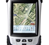
CHC Releases the LT30 GPS/GIS Handheld Collector Shanghai, China – (April 2nd, 2012) – CHC’s new LT30 series enters the GIS data collection market with a cost-effective, rugged and connected GPS/GIS handheld collector for a wide range of applications such as natural resources, forestry, utilities, agriculture, emergency response… Designed for real outdoor conditions, LT30 combines superb brightness…

The Professional Land Surveyor Podcast Episode 4
The Professional Land Surveyor Podcast (PLSP) Shownotes – Episode 4

Leica Geosystems Introduces The Latest Version 4.2 Of Its Leica Spider Software Suite For GNSS Networks and Reference Stations
Leica Geosystems introduces the latest version 4.2 of its Leica Spider Software Suite for GNSS Networks and Reference Stations Leica Geosystems is pleased to release the new version 4.2 of its market leading Leica Spider software suite. The globally used solution for GNSS RTK networks is being continually enhanced and developed following the market needs…