Your cart is currently empty!
Tag: Use
-

Top 3 Reasons Why Land Surveyors Should Know And Use AutoCAD Civil 3D
In this Premium Post I’d like to share with you my three reasons why land surveyors should know and use AutoCAD Civil 3D. Not already a Premium Member? You can register here »»Premium Signup. Two different land surveyors asked me this same question the other day: Why do I need to know and use AutoCAD Civil…
-
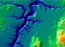
The National Land Survey of Finland Opens Topographic Datasets 1 May 2012 For Free Use
The National Land Survey of Finland Opens Topographic Datasets 1 May 2012 For Free Use The Ministry for Agriculture and Forestry issued a decree on 21 December 2011 on the fees of the National Land Survey of Finland (NLS). The decree prescribes that the NLS will open its topographic datasets to the public on 1…