Your cart is currently empty!
Tag: AutoCAD Civil 3D Templates
-
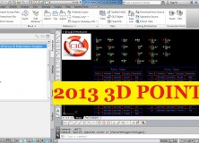
2013 AutoCAD Civil 3D Survey 3D Points Starter Template
I created the 2013 AutoCAD Civil 3D Survey 3D Points Starter Template(s) as a jumping-off point for land surveyors, or anyone using points in AutoCAD Civil 3D, to build their own custom template. The benefits of building from this template are many – saving you many hours of setup and frustrations – but here are…
-
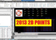
2013 AutoCAD Civil 3D Survey 2D Points Starter Template
I created the 2013 AutoCAD Civil 3D Survey 2D Points Starter Template(s) as a jumping-off point for land surveyors, or anyone using points in AutoCAD Civil 3D, to build their own custom template. The benefits of building from this template are many – saving you many hours of setup and frustrations – but here are…
-

AutoCAD Civil 3D Template Sale
AutoCAD Civil 3D 2011 and 2012 Templates Sale With the release of the first of our 2013 AutoCAD Civil 3D templates, we’re putting our 2011 and 2012 AutoCAD Civil 3D Template on sale. 25% Off 2012 AutoCAD Civil 3D Templates All of our 2012 AutoCAD Civil 3D are marked down by 25%. 2012 AutoCAD Civil 3D…
-

Customized AutoCAD Civil 3D Survey Templates For Land Surveyors, Engineers and Designers
Can your business afford to waste time and money setting up AutoCAD Civil 3D? AutoCAD Civil 3D is a great program …. Once it’s set up and you know how to use it! BUT, getting to that point takes a serious investment in your time, which means lost productivity, billing, and money. And, what if…
-

Land Surveying 911: Should I Pay For AutoCAD Civil 3D Training Or Try To Learn It On My Own?
In this Land Surveying 911 series article, some names have been changed to protect the inquisitive. Submit your Land Surveying 911 request using the form at the end of this article. Steven, who owns a professional land surveying company struggling with switching over to AutoCAD Civil 3D from AutoCAD Land Desktop, submitted the following Land…