Your cart is currently empty!
Month: February 2013
-

AutoCAD Civil 3D 911 Drag & Drop Shapefiles
EMERGENCY AUTOCAD CIVIL 3D 911, HOW CAN WE HELP YOU? In this AutoCAD Civil 3D 911 series article is available to all site members beginning at the Associate Member level. Some names have been changed to protect the inquisitive. Submit your AutoCAD Civil 3D 911 request using the form at the end of this article. AutoCAD Civil 3D 911: AutoCAD…
-

Would You Recommend Land Surveying As A Career Choice For Your Children Or Other Young Relatives?
To Be A Land Surveyor Or Not To Be A Land Surveyor? That Is The Question If your daughter, son, niece or nephew are looking at land surveying or geomatics as a career, would you recommend to them land surveying as a career choice? If you would recommend to them pursuing land surveying as a…
-

Motivational Monday: Don’t Forget To Have Fun! Bonus Video
Here’s the bonus video for Associate & Premium Members, which builds on the last video: Motivational Monday: Don’t Forget To Have Fun! You can watch the Motivational Monday video in that post. In this week’s Motivational Monday episode, I move away from the nose-to-the-grindstone topics of late, and discuss how we need to make sure we’re having some…
-
Motivational Monday: Don’t Forget To Have Fun!
In this week’s Motivational Monday episode, I move away from the nose-to-the-grindstone topics of late, and discuss how we need to make sure we’re having some fun, too! Really, what are we accomplishing with greater productivity and profitability if those endeavors do not improve our lives? Watch the Motivational Monday Video: Don’t Forget To Have Fun!
-

senseFly’s eBee Drone Maps Swiss Alpine Valley Video
There’s a lot of controversy in the US about drones and UAV’s. Resolving safety and privacy are no small issues, but this technology is coming and offers an opportunity for land surveying and geomatic companies to enter the aerial mapping markets. Will you be ready when the drone mapping opportunity strikes? Watch the senseFly’s eBee Drone…
-

Professional Land Surveyor Weekly Roundup February 24, 2013
Professional Land Surveyor Weekly Roundup: Surveyor’s Saturday Serendipity: 1850 Survey Plat Title and Trees Motivational Monday: Celebrate Your Daily Successes Bonus Video Motivational Monday: Celebrate Your Daily Successes Professional Land Surveyor Weekly Roundup February 17, 2013 FAA Announces Request for Proposals For Unmanned Aircraft Systems Research and Test Sites Surveyor’s Saturday Serendipity: Drones for Aerial…
-

Surveyor’s Saturday Serendipity: 1850 Survey Plat Title and Trees
A wee bit of Surveyor’s Saturday Serendipity with a few pictures of an 1850’s survey plat I found this week. Of note about this survey plat are three things: The survey plat’s title, with interesting wording stating survey scope limitations (see photo to left). The nicely drawn and colored trees (see photos below). Large colored…
-

Motivational Monday: Celebrate Your Daily Successes Bonus Video
Here’s the bonus video for Associate & Premium Members, which builds on the last Motivational Monday: Celebrate Your Daily Successes post. You can watch the Motivational Monday video in that post. Watch the Motivational Monday: Celebrate Your Daily Successes Bonus Video:
-
Motivational Monday: Celebrate Your Daily Successes
In this new feature I want to start everyone’s week off with some motivation for success in the week ahead. In this episode, I discuss how to build on positive experiences by celebrating your daily successes. Too often, we are crippled by negativity and place our focus on what went wrong or wasn’t finished on…
-

Professional Land Surveyor Weekly Roundup February 17, 2013
Professional Land Surveyor Weekly Roundup: FAA Announces Request for Proposals For Unmanned Aircraft Systems Research and Test Sites Surveyor’s Saturday Serendipity: Drones for Aerial Surveying+EPIC Launcher! New Build of ArcGIS Explorer Desktop Tightens Integration with ArcGIS Online Land Surveying Challenge 0001 NJ Professional Land Surveyors Map Contest Winners | Fralinger Engineering Motivational Monday: Conquer Fear…
-

FAA Announces Request for Proposals For Unmanned Aircraft Systems Research and Test Sites
WASHINGTON – The Federal Aviation Administration (FAA) today solicited proposals from state and local governments, eligible universities and other public entities to develop six unmanned aircraft systems (UAS) research and test sites around the country. Through the FAA Modernization and Reform Act of 2012, Congress directed the FAA to establish this program to conduct critical…
-

Surveyor’s Saturday Serendipity: Drones for Aerial Surveying+EPIC Launcher!
A wee bit of Surveyor’s Saturday Serendipity of aerial surveying with an EPIC launcher!. Come fly with me, let’s fly, let’s fly away……
-

New Build of ArcGIS Explorer Desktop Tightens Integration with ArcGIS Online
Easier Sharing, Attribute Table Display, and New Presentation Tools Are Among Improvements The most recent ArcGIS Explorer Desktop release includes new features and enhancements to make it a more powerful tool in an enterprise GIS, including content sharing via ArcGIS Online, tabular information display, and new presentation tools. ArcGIS Explorer Desktop is a free GIS viewer that…
-
Land Surveying Challenge 0001
Welcome to Land Surveying Challenge 0001. This land surveying challenge, challenge information and data are available to Members. Premium Members can downloadable the Land Surveying Challenge 0001 pdf file. You can also purchase the Land Surveying Challenge 0001 pdf file on our store – Learn More. The Challenge You’re surveying record parcel 2 in the Parkhurst Plat. Record parcel…
-

NJ Professional Land Surveyors Map Contest Winners | Fralinger Engineering
Charles M. Fralinger, President of Fralinger Engineering, is pleased to announce that three (3) members of the Fralinger Engineering staff have been recognized by the New Jersey Society of Professional Land Surveyors through the Cornelius (Neil) Carmody Memorial map contest. The Carmody Memorial map contest is held each year where maps are submitted by Land…
-

Motivational Monday: Conquer Fear Led Avoidance
In this new feature I want to start everyone’s week off with some motivation for success in the week ahead. In this episode, I discuss how we too often allow ourselves to avoid the tasks and responsibilities we know we should do. Instead, we choose to tackle the easier tasks, rather than the important tasks.…
-
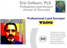
PLS Vlog 006 February News and Updates
Professional Land Surveyor Vlog 006 February News and Updates I’m excited to let you know about new website focus and interweb projects updates. Watch the Professional Land Surveyor Vlog 006
-

Professional Land Surveyor Weekly Roundup February 10, 2013
Professional Land Surveyor Weekly Roundup: Professional Land Surveyor Archive – Last 3 weeks: Updates Around The Interwebs: The Autocad Civil 3D Daily ASCENT- Center for Technical Knowledge® Releases 57th Autodesk Official Training Guide for Autodesk® 2013 Software Geomatics Today A new major to look at – Geomatics The Professional Land Surveyor Daily Professional Surveyor: History Corner: A…
-

Surveyor’s Saturday Serendipity: Land Surveyor and an injured Goldfinch Video
A wee bit of Surveyor’s Saturday Serendipity with a land surveyor and an injured Goldfinch. Land surveyors are a helpful lot, aren’t they?
-
AutoCAD Civil 3D 911 Create Curve From End of Object
EMERGENCY AUTOCAD CIVIL 3D 911, HOW CAN WE HELP YOU? In this AutoCAD Civil 3D 911 series article is available to all site members beginning at the Associate Member level. Some names have been changed to protect the inquisitive. Submit your AutoCAD Civil 3D 911 request using the form at the end of this article. AutoCAD Civil 3D 911:…